NV5 utilizes a variety of hydrographic survey data inputs (lidar, topobathy lidar, thermal, hyperspectral) in order to build a robust collection of hydrologic models that allows us to understand and communicate complex relationships in the field of hydrology. Our data scientists cover hydrological disciplines that span the entire water usage cycle- from sources, to distribution, to usage.
3D Hydrography Program (3DHP)
Our team has worked closely with the USGS Hydrography team on both the 3D Hydrography Program (3DHP) and the Watershed Boundary Dataset (WBD). This collaboration, in conjunction with our deep understanding of client needs and creative approach to solution development, has enabled us to develop new concepts and processes that support the increased complexity of 3DHP, meet specific needs of end users, and contribute to the next generation of hydrography data.
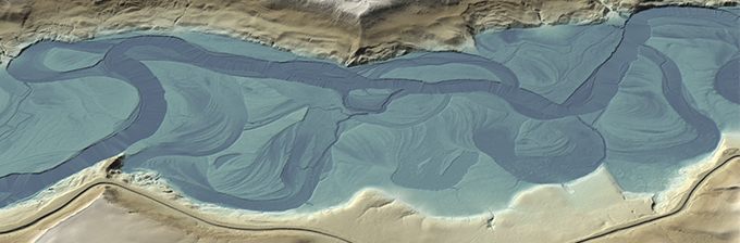
Flow Delineation
Gain insight into hydrologic processes such as watershed delineation, stream channel determination, paleo-channel identification, and overland flow routing.
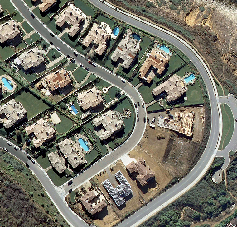
Irrigated Landscape Analysis
Analysis of land use, surfaces, and flow in combination with property data can determine the effects of built environments on water usage.
Heat Source
Understand stream temperature relationships to manage water distribution and aquatic habitat quality. Through hydrographic survey technology, NV5 produces informative visualizations of stream temperature methodologies including thermal analyses for river habitat, flow diversion scenarios, sun/shade analysis, and source determination.