If you…
…then you may be familiar with Alaska Channel 11 KTVA’s Workforce Wednesday, a segment of the morning show, “Day Break,” which hosts local businesses to share what they do in order to help Alaskans learn about rewarding careers. Alaska Process Industry Careers Consortium (APICC), is a proud participant in the segment. Recently Quantum Spatial was featured to discuss all things related to geospatial sciences.
Geospatial Sciences and Remote Sensing
Alaska is a big place. Large parts are not reachable by road. Its unique geography includes the tallest mountain in the US, and Alaska’s coastline is many times larger than the total coastline of all the other states. The industry of geospatial sciences provides solutions to gathering information about the land to better inform decisions regarding conservation and resource management.
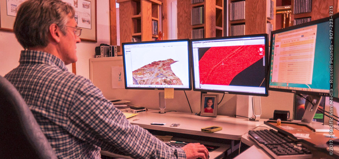
Quantum Spatial’s involvement in geospatial sciences is as vast as the Alaskan frontier. A longtime expert in survey and data acquisition, Quantum Spatial collects geospatial data, like: aerial photos, LiDAR, and both thermal and hyperspectral imaging. Additionally, the company employs scientists and industry experts to analyze the data, transforming it into valuable information for a wide range of industries including forestry, aquatic sciences, electric utilities, oil and gas, and emergency response. To access the large amounts of data, Quantum Spatial also designs and develops mapping software, which displays the information in maps, charts, and tables.
Stephen Sparks, Geospatial Scientist
Quantum Spatial continues to expand the possibilities of geospatial science via new technologies and methodologies. Just ask Stephen Sparks, an imaging specialist, who has been with Quantum Spatial and its legacy companies for 38 years. Steve has seen the field of geospatial sciences evolve, and it’s one of the things he loves most about the job.
“I have been able to do a lot of things over the decades. I’ve been involved with ever changing technology, which has kept the job exciting.”
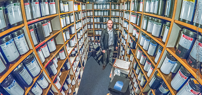
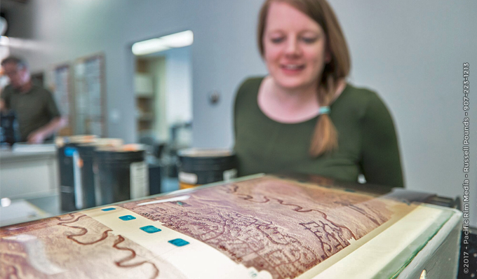
During his career, Steve has worked as a sensor operator, a photo lab technician, project manager, and data archivist. He enjoys working with Quantum Spatial’s extensive archive of historical photos, which dates back to the 1930’s. The archive is useful to analyze changes over time, aiding in ecological efforts, litigation suits, and planning initiatives. Stephen also loves working with clients, whether it’s a new client, discovering the benefits of geospatial data for the first time, or longtime partners meeting to discuss additional services.
Lights, Action, Camera
Here are some of the photos on the set of Workforce Wednesdays and in the Quantum Spatial office, generously provided by Pacific Rim Media.
At the station:


At the Quantum Spatial office: