Located in the Seattle metropolitan area on an island in the southern portion of Lake Washington, Mercer Island has a population of over 25,000 residents. The City’s water utilities systems rely on geospatial technology to provide data to City users for operations, maintenance planned repairs and upgrades, and as a data stream for other City systems.
In recent years, as part of their commitment to staying at the front of technological advancements, the City has invested in Cityworks’ GIS-centric Asset Management System and gained situational awareness by deploying real-time streaming data and replacing meters with smart meters. This forward-leaning approach to technology adoption and innovation, demonstrated by their core use of Esri technologies such as ArcGIS Pro, ArcGIS GeoEvent, ArcGIS Hub, and ArcGIS Monitor, as well as their use of Cityworks for enterprise asset management and Geocortex for web mapping support, highlights the City’s dedication to leveraging GIS solutions to address various business challenges. This phased approach to technology integration not only helps users understand the capabilities but also ensures seamless incorporation into standard operations.
The Challenge
Though the City had identified Utility Network as the right fit network management solution, budget concerns meant the implementation project may not have priority. Fortunately, since the project was focused on improving the state of the City’s utilities, it was eligible for funding through the American Rescue Plan Act (ARPA). Through a grant application that, with NV5’s guidance, outlined the scope of work and benefit to the community, the City received the funding that accelerated the UN implementation project.
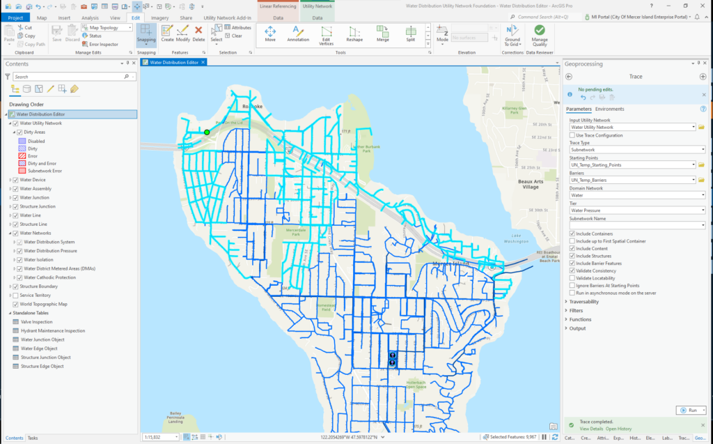
Operations for the water team at Mercer Island were functional; they had a mature system within the geometric network that worked well for them, and users in the field and in the office understood what their systems and software were capable of and made use of them as best they could. For the City, upgrading to ArcGIS Utility Network was a prime example of their mantra of taking a phased approach to new technology adoption. Implementing UN would address a number of issues: that geometric network would not be supported in the future, the UN would provide improved processes for cleaner and more reliable data, new functionalities and integrations would improve efficiencies, and they’d be able to take their time with the implementation. This meant they could start with one utility, water, to learn best practices, and then apply those lessons to bring other systems including wastewater and stormwater to the UN.
The Approach
The City’s partnership with NV5 for ArcGIS Utility Network implementation was built upon their previous successes in upgrading from ArcMap to ArcGIS Pro, deploying ArcGIS Enterprise (including an upgrade to 10.9.1), and setting up an ArcGIS Hub site. With this established and successful relationship, collaborating with NV5 was a clear choice.
The approach to UN implementation was strategically structured, beginning with NV5’s “UN Readiness Assessment” and following with the “Jump Start” project, and culminating with NV5 in a supporting role as the City worked to complete the remaining UN migration steps.
- UN Readiness Assessment: During this project, the City’s data and systems were reviewed, producing valuable recommendations and a clear roadmap for the UN implementation. This phase not only laid the project’s foundation but also defined its scope and objectives, ensuring alignment with the City’s goals.
- Jump Start: The “Jump Start” project initiated hands-on work, resembling a short-term boot camp for UN implementation. The City actively collaborated with NV5, becoming skilled in UN technology, equipping them to manage it effectively. This phase aimed to assess the current state of the City’s data and determine the level of effort required for UN readiness. Beyond this, NV5 provided knowledge transfer, ensuring the City’s team was well-prepared to independently address UN challenges, empowering them with the skills and knowledge to navigate the UN landscape.
- Ongoing Support: Recognizing that implementation projects often encounter hiccups, NV5 committed to providing continuous support. Whenever the City faced problems or had questions, NV5 was readily available to offer guidance and solutions.
The team decided on a workshare approach to the project to balance budget and time constraints. This afforded the City access to NV5’s experts while performing as much of the project work as they could, with NV5’s guidance and support. An important starting point to the workshare approach is assessing the utility’s data and defining the necessary levels of effort to prepare it for integration into the UN and whether the City or NV5 would take the lead on each task.
This also kept the project within budget, gave the team the opportunity to be hands on with the technology so they could manage it effectively, and allowed the City to tackle the most complex issues first. NV5 initially provided how-to sessions for knowledge transfer, and afterward, the City’s team took the lead in the Utility Network’s operations. When they ran into a problem or had questions, NV5 would jump back in to walk them through it.
The Results
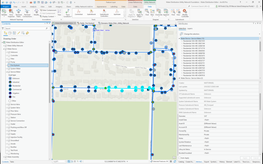
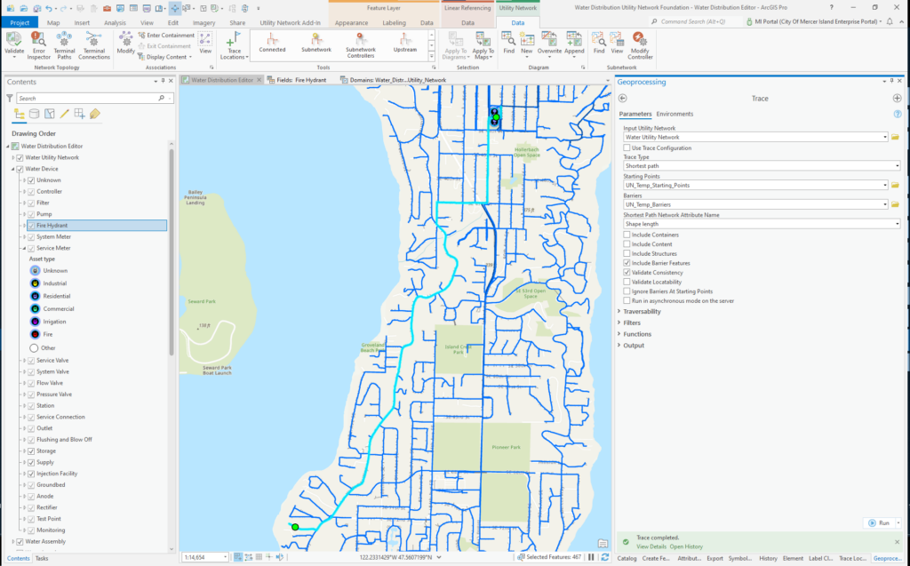
The City of Mercer Island has reached significant milestones in adopting the Utility Network for their water utility. The team has worked to develop a data model that blends required source data with the base UN schema and is working with UN in a development environment to prepare for implementation in their production environment. The knowledge transfer from NV5’s experts to the City’s team has prepared them to complete the preparations and be confident to go live into production with UN. The City is working towards ensuring a smooth transition for all data integrations, with Cityworks integration being a top priority.
The City’s GIS team is driving the transition with confidence by pushing the possibilities of Utility Network and showcasing what the solution can do for their staff, field crews, and other departments.
The City expects great things from their 5-year IT/GIS strategic plan, beginning with their enterprise upgrade, Utility Network migration, and image server transition. With the support of the NV5 team, they are set up for success for the next phase of their GIS transition.
Is your organization considering a Utility Network migration? From data assessment to knowledge transfer, NV5 Geospatial can support your team every step of the way. Schedule a meeting, and let’s work together to help your organization work smarter, not harder.