We’re recapping the 2024 Esri Developer Summit with insights from the event earlier this month on product updates, new technology, emerging trends, and other big news in the Esri world. From ArcGIS Knowledge to AI to APIs, we asked a few of our attendees to share their biggest takeaways from the event. Read on to learn more.

I’ve been with NV5 for 2.5 years now but have been in the Geospatial Industry for over 24 years. This was my 9th (maybe 10th) Developer Summit. I always liken the DevSummit to cramming an entire semester of college into a single week. You learn a ton and have great opportunities to interact with the Esri staff and fellow Geo Geeks from around the world and that can really give you a renewed energy and ideas on how best to serve our customers.
Key Takeaway #1: Data Integration
Service Object Interceptors (SOI’s) Webhooks and Custom Data Feeds. All provide the ability to extend ArcGIS Enterprise by integrating with external data sources and services. They provide ways to ingest and use data from other business systems, non spatial data and legacy systems, they can be event driven, provide fine grain control over what happens and when and to varying degrees be configured to pull data into the GIS or push it to other systems. Enabling our clients to gain new insights from seemingly disparate pieces of data… See Takeaway #2
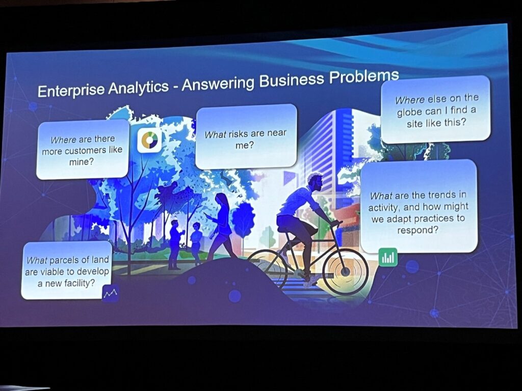
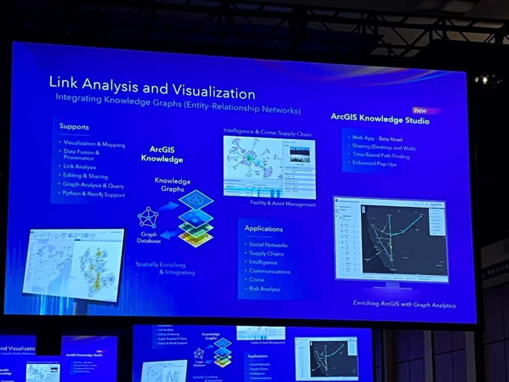
Key Takeaway #2: ArcGIS Knowledge and Data Analytics
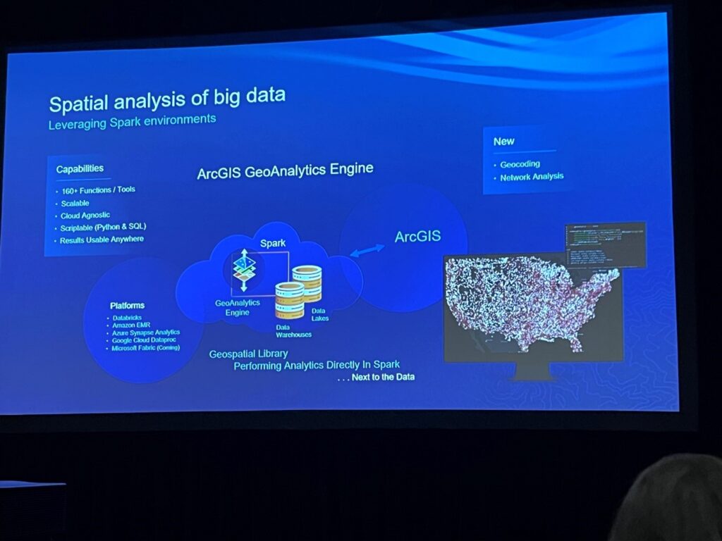
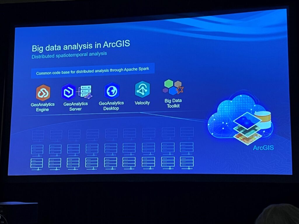
Being able to bring pieces of data together from different business systems is great and who wouldn’t want to see all their data on a map? However the real value comes from analyzing that data for trends, hidden relationships and deeper insight and then making predictions about the data or uncovering other related things. Esri continues to make this easier through tools like ArcGIS Knowledge a Graph Database implementation for ArcGIS and Geoanalytics Engine and the Big Data toolkit. Being able to link data and define relationships in intuitive ways and then analyze those relationships with GeoAI and deep learning tools to help determine correlations between data attributes and the effect that time and location have on them is a game changer for making client data actionable. And then being able to predict whats next or what other relationships may exist through GeoAI predictive analysis and recommendation engines takes things to a whole other level.
Key Takeaway #3: ArcGIS API for Python Enhancements
Esri is continuing to make enhancements and introduce new functionality into the ArcGIS API for Python. A number of these new enhancements focus on improving the functionality and experience when working with and managing ArcGIS Configurable applications like Experience Builder, Storymaps and Survey 123. Among these, the ability to clone/migrate Experience Builder applications between portals is particularly welcome, especially the optional parameters that can allow copying all associated content or if the content has already been migrated, search for and remap it.

I’ve been with NV5 for nearly two years, and this is my second DevSummit I’ve attended. It’s always a great experience to meet people, see what new technologies are coming, and generating ideas that I can directly put into practice here at NV5.
Key Takeaway #1: The AI Revolution and Esri: GeoAI
Esri has been bit by the AI bug, and they were promoting it in a big way at the Summit this year. I was even interviewed by Esri for a survey on my opinions of AI and how I would use it. One of the biggest uses is for imagery analysis, detecting if a shape is a plane, a building, or a developer working on their laptop outside, and if other than a building, figuring out what it might doing. Beyond imagery analysis, they also explored using AI assistants for local government, helping connect residents to their local authorities and understand what they need to do, who they need to contact, where to go, and especially with GIS, if they’re even in the jurisdiction. (As someone who lives inside a tiny salient, where one jurisdiction juts into another for no discernible reason, I feel this in my bones.) As a developer who works with Experience Builder and building web interfaces for users, what really piqued my interest was a pretrained AI model designed to “clean” user input, specifically with addresses. We have many clients who have a need to run analysis on CSVs with hundreds or even thousands of addresses, and I would not wish having to check each address for typos on anyone — anyone other than an AI, that is. I’m already thinking about how to use this to make our users lives’ less tedious and frustrating.
Key Takeaway #2: Knowledge Graph
In addition to AI, Esri is showcasing Knowledge Graph, which is their take on graph databases. My experience with databases has been almost entirely with relational databases — i.e., SQL/MariaDB — with a little sprinkle of document-based databases — such as MongoDB — on the side. A graph database, instead of being based on tables (SQL) or JSON documents (MongoDB) instead looks like a mind map, with every piece of data having a link to an arbitrary (though at least one) number of other pieces. (In a way, it combines the flexibility of document databases with the relationships power of table databases.) This means no more complicated JOINs or junction tables, which should hopefully mitigate some of the effects of frustration-induced manual alopecia that can affect database administrators and developers. Now, we can simply connect the lines between related data. Esri is also adding the feature to create knowledge graph layers and add those to our webmaps. At the moment, it seems to be an ArcGIS Enterprise/ArcGIS Pro offering at this time, requiring a ArcGIS Knowledge Server site to be federated with the rest of your Enterprise setup.
Key Takeaway #3: Custom Data Feeds & Koop.js
A large portion of my work as a web developer is getting data from a source and placing that somewhere new where users can examine it. In many cases, the data is not in the right format and needs to be converted; in any web development project, this can be a thorny obstacle, and that’s doubly so when it comes to geospatial data. Fortunately, Esri is sponsoring an open-source project called Koop.js which takes data from any number of providers, converts it to GeoJSON, and then reconverts that into a new format for an output. Each provider and output is a plugin, and while Koop.js has its own, you can make your own. Many of the plugins are for “non-traditional” geospatial data sources; for example, there are plugins for importing data from Salesforce, Zillow, Google Analytics, and even GitHub. Esri has taken Koop.js and used it as the basis for Custom Data Feeds, a new ArcGIS Enterprise feature that makes it easier for organizations to import and consume custom content in their Enterprise set ups, but with Koop.js being open source and based on JavaScript, I can bring similar functionality to ArcGIS Experience Builder applications, without needing the Enterprise overhead.

Even though I’ve worked in GIS roles for a decade and with NV5 for several years, this was my first DevSummit. The deep exposure to product road maps, best practices, and technical design and implementation considers across Esri’s portfolio was an intense experience for just one week. It far outstripped similar conferences I’ve attended in the past. Just as important to me was the opportunity to meet with colleagues past and present, kicking around ideas that would have helped with past challenges and thinking about how new developments unveiled at the DevSummit would apply to future solutions.
Key Takeaway #1: GeoAI
I soaked in as much as I could from the GeoAI technical sessions. The maturity and utility of the models, tools, and APIs opens up possibilities to manage increasing amounts of data collected with greater frequency than ever before and deliver substantial value to GIS stakeholders. The object detection and classification processes sparked a lot of ideas for solutions built on drone imagery and inspection photos. I really enjoyed the Survey123 ‘Smart Assistant’ demo using the same model to parse photos collected in the field to answer questions on the for prior to submission. These models and tools should contribute to more processing and tighter feedback cycles for users observing their assets or the environment around them. All the GeoAI sessions left me with the impression that if I’m not using AI now, then I’m not engaging my tools or the data in the best way.
Key Takeaway #2: ArcGIS Image Server & ArcGIS Image
Imagery and raster management seems to be more comprehensive and accessible over time. The latest capabilities of ArcGIS Image Server and ArcGIS Image for ArcGIS Online enable both insightful analytics and compelling visuals to describe an entire landscape. I’ve worked with a lot of organizations maturing their capabilities and moving towards cloud native solutions. I see the Imagery solutions as an excellent pilot use case for organizations exploring transitioning from their traditional on-premises infrastructure, whether they want to fully embrace a cloud deployment or hybrid solutions that leverage cloud stores or SaaS technologies.
Key Takeaway #3: ArcGIS Monitor
The ArcGIS Monitor sessions and its roadmap were extremely useful in understanding how to tackle system administration for the ArcGIS Enterprise platform going forward. The release cadence for the current version of ArcGIS Monitor pushes more functionality into GIS administrator and engineer hands, allowing them to engage with emerging issues before they trigger outages as well as triage the system during serious incidents. I’m looking forward to the future functionality where alerts can be tied to scripts to remediate previous scoped conditions.

I am approaching my 2.5 years mark working at NV5 and this was my second Esri Dev Summit. My last Esri Dev Summit was in 2009 and a lot has changed in the Esri ‘world’ since then.
I always enjoy a good Esri conference, especially conferences that offer different insights into how to work within Esri’s ‘environment’. However, this conference was pleasantly different as not only was I able to attend but also got to finally meet, in person, some of the wonderful individuals that I work with daily but am only able to see them from a laptop’s camera view.
Key Takeaway #1: SOEs & SOIs
Learning about how to configure and implement Server Object Extensions (SOEs) and Server Object Intercepts (SOIs) looks like it could be a very useful tool/solution we can begin to offer our customers. In a nutshell, these two technologies allow for the extension and/or creation of customized GIS related workflows that utilize existing infrastructure the client potentially already has purchased.
Key Takeaway #2: ArcGIS Experience Builder Best Practices
In the session titled “ArcGIS Experience Builder Best Practices for Designing and Building Web Experiences”, the authors covered some of the best practices when designing and building web-based GIS applications. Having this knowledge, myself and other NV5 GIS-centric individuals now have a broader understanding of how to build beautiful, highly functional, and efficient GIS applications. As the work we do for our customers, reflects not directly on us at NV5, but directly on the customers for whom we do the work, I feel producing a superior product is an absolute must, and now we have more tools to do so.
Key Takeaway #3: ArcGIS API for Python
One of the key GIS tasks I frequently assist with involves updating feature layers within our clients’ AGOL environment. Recently, I attended a session titled “Automated Web Layers Updates with Pandas and the ArcGIS API for Python,” which provided an overview of a Python module developed by a Utah-based organization. This module is accessible to anyone interested in utilizing it. Once again, it’s another valuable tool at our disposal as GIS professionals to fulfill client requests for GIS support.
Additional Guidance:
Want to learn more about any of the technologies we covered in this blog, or how your organization can best leverage Esri technologies to solve business challenges? Schedule a meeting with our experts to discuss.