
Author: Kiran Pallachulla, CFM, ENV SP, GISP, CPESC, QSD/P, Senior Water Resources Engineer
Infrastructure projects such as roads, buildings, and bridges, have the potential to disrupt the natural flow of stormwater runoff. This disruption can result in issues such as flooding, erosion, and water quality deterioration. Continuous simulation modeling and analysis serve as valuable tools for calculating stormwater runoff from infrastructure projects and evaluating their influence on stormwater runoff to the watershed.
Advantages of Continuous Simulation Modeling and Analysis
Numerous factors underscore the value of continuous simulation modeling and analysis for calculating stormwater runoff from infrastructure projects. These include:
- assessing the long-term performance of stormwater management systems.
- identifying and quantifying the impacts of climate change on stormwater runoff.
- developing and evaluating stormwater management strategies that are designed to reduce the risk of flooding and other stormwater-related problems.
- Supporting decision-making about the design and operation of stormwater management systems.
Ideal Conditions for Employing Continuous Simulation Modeling and Analysis
Continuous simulation modeling and analysis are most effective when applied in watersheds where a thorough comprehension of the hydrologic and hydraulic processes governing stormwater runoff exists. This encompasses possessing data on rainfall, evaporation, and other hydrologic variables, along with information about the physical attributes of the watershed, such as land cover, topography, and soil characteristics. A comprehensive understanding of the hydrologic and hydraulic processes governing stormwater runoff is essential for effective utilization.
Constraints of Continuous Simulation Modeling and Analysis
Continuous simulations modeling and analysis also has some limitations:
- Long-term and continuous historical data may not always be readily available, potentially limiting the accuracy of the analysis.
- The setup and execution of continuous simulations modeling can be intricate and time-consuming.
- The procurement and maintenance of the necessary software for running continuous simulations models can be costly. In some cases, additional investment in high-performance hardware (e.g., computers with multiple processors and ample memory) may be required to expedite the analysis.
Commercial and Free/Open-Source Software Programs and Tools at Your Disposal
Numerous popular software programs and tools are accessible for continuous simulation modeling, spanning both free and open-source options as well as commercial ones. The following represents only a small selection of available tools and their inclusion does not imply endorsement or recommendation.
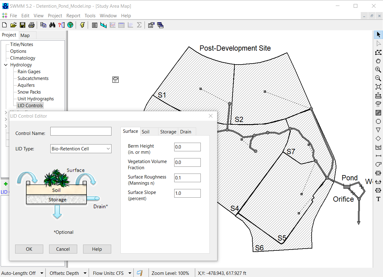
- Stormwater Management Model (SWMM or EPA-SWMM) is an opensource software program developed by the U.S. Environmental Protection Agency for simulating stormwater runoff and flooding. SWMM can be used to simulate a wide range of hydrologic and hydraulic processes, including rainfall-runoff, infiltration, and routing.
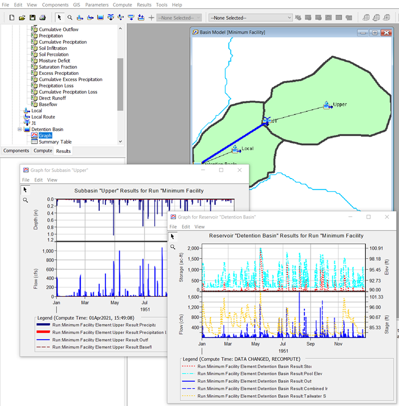
- HEC-HMS is a free software program developed by the U.S. Army Corps of Engineers for hydrologic modeling and simulation. HEC-HMS can be used to simulate a wide range of hydrologic processes, including rainfall-runoff, snowmelt, and reservoir operations.
- SWAT is a free and open-source software program developed by the U.S. Department of Agriculture for simulating the impacts of land management practices on water quality and hydrology. SWAT can be used to simulate a wide range of hydrologic processes, including rainfall-runoff, evapotranspiration, and nutrient cycling.
- OpenFOAM is a free and open-source software program for computational fluid dynamics (CFD) modeling. OpenFOAM can be used to simulate a wide range of fluid flow problems, including stormwater runoff.
- InfoWorks ICM is a commercial software program developed by Innovyze for integrated catchment modeling. InfoWorks ICM can be used to simulate a wide range of hydrologic and hydraulic processes, including rainfall-runoff, flooding, and drainage.
- HydroCAD is a commercial software program developed by HydroCAD Software Solutions for stormwater runoff modeling. HydroCAD can be used to simulate a wide range of hydrologic and hydraulic processes, including rainfall-runoff, infiltration, and ponding.
- Commercial SWMM models like PC-SWMM or other.
Choosing the Right Software Program or Tool for Your Needs
The choice of the most suitable software program or tool depends on various factors, including the specific needs, budget, project location, and sometimes the agency responsible for reviewing the analysis. When budgets are a constraint, it is important to consdier utilizing free and open-source software programs like EPA-SWMM, HEC-HMS, SWAT, or OpenFOAM. On the other hand, with a more substantial budget, commercial software options such as InfoWorks ICM, HydroCAD, and Commercial SWMM (PC-SWMM, etc.) might be worth exploring.
Continuous simulation modeling and analysis is a valuable tool for calculating stormwater runoff from infrastructure projects. It serves multiple purposes, including assessing the long-term performance of stormwater management systems, quantifying the effects of climate change on stormwater runoff, developing and evaluating stormwater management strategies, and aiding decision-making regarding the design and operation of stormwater management systems.
Should you need help selecting the most appropriate continuous simulations model for your project, contact us at 562.495.5777 or Kiran Pallachulla, Senior Water Resources Engineer, Kiran.Pallachulla@NV5.com .