The Path to Smarter, Connected Asset Management
Organizations everywhere are working toward AI-driven operations, but legacy and on-prem systems often stand in the way. Trimble Unity changes that. It’s not just another
Organizations everywhere are working toward AI-driven operations, but legacy and on-prem systems often stand in the way. Trimble Unity changes that. It’s not just another
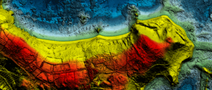
Through its subsidiary, Marine Taxonomic Services, Ltd. (MTS), an environmental consulting firm specializing in marine and aquatic sciences, NV5 has extended its hydrospatial services to
Frankfurt, Germany — NV5, a division of Acuren Corporation (the “Company” or “Acuren”, NYSE: TIC), a provider of tech-enabled engineering, certification, consulting, and geospatial solutions,
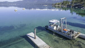
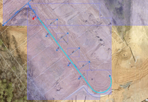
With over 5,300 miles of U.S. coastline, the Great Lakes are a cornerstone of North American commerce, ecology, and recreation. For nearly a decade, the
By Michael Parma, Senior Solutions Architect, NV5 The clock is ticking on Esri’s Geometric Network (GN), and for utilities still relying on it there are

Hi there, join us for this upcoming webinar! Wednesday, September 24 Noon ET / 11am CT With Esri’s geometric network retiring in March 2026, water utilities are

Helping Infrastructure, Transportation and Utility Leaders Stay Ahead of Landslides, Subsidence, and Slope Failures Geohazards such as slope instability, erosion, settlement, or seepage pose ongoing

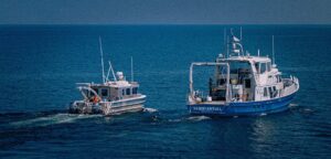
Wednesday, August 27 at 2 PM ET / 1PM CT In this live webinar, you’ll discover how our latest hydrographic survey innovations, developed and refined

The defense and intelligence community is entering a new era of autonomy, one defined by AI-driven workflows that are reshaping how we handle geospatial intelligence

Join us for Geo Sessions, a premier online thought leadership event happening September 16–18. This three-day event welcomes over 20 experts from public organizations, academia, and commercial