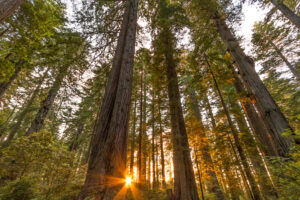
NV5 Geospatial Speaks for the Trees
https://www.youtube.com/watch?v=-uK4fObNyWs&authuser=0 In honor of Arbor Day, we’re sharing Dr. Andrew Brenner’s presentation on remote sensing data applications and analysis for forestry and tree sciences. For
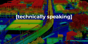
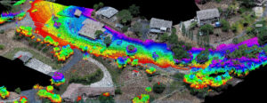
Dive into our latest Technically Speaking article to understand the intricacies of geospatial accuracy and considerations to achieve reliable, quality lidar data. This is the

Find your way with NV5 Geospatial’s data analysis for oversize freight transport. View Flyer NV5 Geospatial uses lidar to perform three-dimensional swept path clearance analysis for
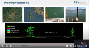
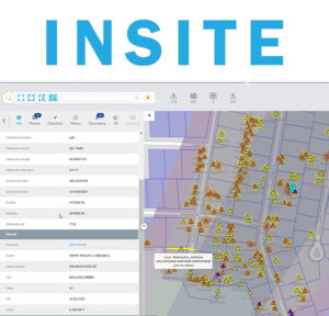
Sven Cowan, Canada Program Manager for NV5 Geospatial, discusses the capabilities of INSITE Project Tracker a cloud-based data application for Go Geomatics Canada. The INSITE

Listen The UAV Podcast discusses how drones and other autonomous vehicles are deployed with lidar sensors to create 3D mapping data and downstream

It is Haiku Day! If you enjoy, like and share our fun collection Read

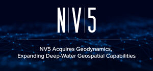
HOLLYWOOD, Fla., March 29, 2021 (GLOBE NEWSWIRE) — NV5 Global, Inc. (the “Company” or “NV5”) (Nasdaq: NVEE), a provider of compliance, technology, and engineering consulting

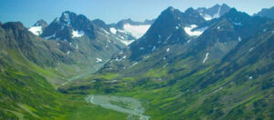
Registration is open for the Alaska Virtual Geospatial Gathering March 1st – 4th. We have over two dozen speakers lined up to cover geospatial topics

NV5 Global, Inc. (the “Company” or “NV5”) (Nasdaq: NVEE), a provider of compliance, technology, and engineering consulting solutions, announced today that NV5 Geospatial, formerly Quantum Spatial,
Fill out the form below to download the handbook.
"*" indicates required fields
Please fill out the form below. After successful form submission, you will be redirected to the requested file. Thank you.
"*" indicates required fields
Our internal innovation and development team constantly analyzes new technology and develops solutions to meet our client’s challenges. Our Technically Speaking series is one way we share our technical findings with the professional community.
Please tell us a little about yourself by filling out the form below, and we’ll share the document with you, thanks!
NV5 Geospatial releases a new predictive modeling platform for vegetation management that uses existing lidar and historical data to identify the relative level of asset risk from trees by quantifying the potential for causing asset damage.
Please tell us a little about yourself by filling out the form below, and we’ll share the document with you, thanks!
Our internal innovation and development team constantly analyzes new technology and develops solutions to meet our client’s challenges. Our Technically Speaking series is one way we share our technical findings with the professional community.
Please tell us a little about yourself by filling out the form below, and we’ll share the document with you, thanks!