
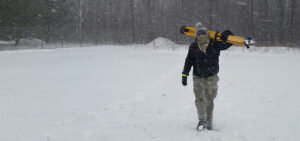
Meet Andre, Quantum Spatial Sr Geodetic Analyst!
In celebration of National Surveyors Week, we’re spotlighting some of our dedicated surveyors and sharing their insights of a survey career. If you are interested
In celebration of National Surveyors Week, we’re spotlighting some of our dedicated surveyors and sharing their insights of a survey career. If you are interested

Hosted by DM radio, Quantum Spatial’s Anand Iyer participates in a panel discussion about companies that harness big data to provide solutions to wide-ranging real-world challenges.

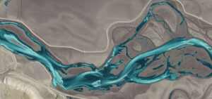
The new year is here, have a downloadable desktop calendar that showcases an amazing view of Kipnuk, Alaska. There are two different image sizes to accommodate variation
ST. PETERSBURG, Fla., Jan. 29, 2019 (GLOBE NEWSWIRE) — Quantum Spatial, Inc. (QSI), the nation’s largest independent geospatial data firm, this week was presented with two MAPPS

As the pace of innovation continues at a breakneck pace throughout the remote sensing industry, new applications for spatial data are emerging. Quantum Spatial’s Anand
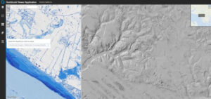
In the latest issue of GIM International, Quantum Spatial’s Cherie Jarvis discusses the process of utilizing eGIS mapping applications in order to improve outcomes of
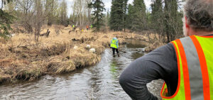
Quantum Spatial made headlines this past weekend helping to keep Anchorage’s waterways clean. Marking the third consecutive year, the team participated in Anchorage Waterways Council’s Creek Cleanup.
Cherie Jarvis, Quantum Spatial’s Enterprise GIS Practice Lead, recently shared her insights into the benefits and best practices of agile software development in a SD
In celebration of National Surveyors Week, we’re spotlighting some of our dedicated surveyors and sharing their insights of a survey career. If you are interested

In celebration of National Surveyors Week, we’re spotlighting some of our dedicated surveyors and sharing their insights of a survey career. If you are interested