Battling Climate Change in the Caribbean
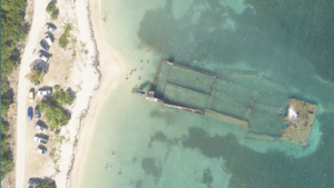
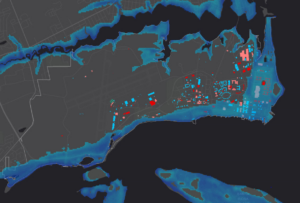
The Caribbean is a region known for its vibrant culture and breathtaking landscapes. However, it is also particularly vulnerable to the impacts of climate change.
The Caribbean is a region known for its vibrant culture and breathtaking landscapes. However, it is also particularly vulnerable to the impacts of climate change.

Kentucky Project Spanning 40,660 Square Miles Democratizes Access to Detailed Information to Improve Public Safety and Bolster Revenue Generation Across the CommonwealthHOLLYWOOD, Fla., April 11,
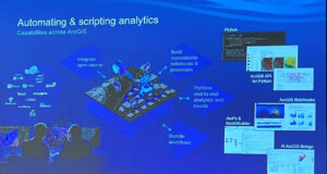
We’re recapping the 2024 Esri Developer Summit with insights from the event earlier this month on product updates, new technology, emerging trends, and other big

Located in the Seattle metropolitan area on an island in the southern portion of Lake Washington, Mercer Island has a population of over 25,000 residents.
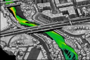
NV5 Geospatial’s Thermal Infrared Solutions Gain Traction for U.S. Infrastructure Challenges Pilot projects with two midwestern state’s Departments of Transportation analyze the structural integrity of
NV5 Geospatial Honored with Missouri Conservation Innovation Partner Award NV5 Geospatial and Aerial Services Inc. Highlighted for Ground-Breaking 3D Elevation Derived Hydrography Project to Map

NV5 has been honored with the Utility Network Implementation award at the 2023 Esri Infrastructure Management and GIS (IMGIS) Conference in Palm Springs, California. The

Single partner for combining engineering-grade data acquisition with geospatial analytics and solutions to support operational business decisions at airports HOLLYWOOD, Fla., August 22, 2023 – NV5
CMQuébec contracted NV5 to collect the topobathymetric Lidar data during leaf-on conditions for an area of interest containing eight rivers surrounding Québec City. The community
The Navy Shore Geospatial Energy Module (NSGEM) is an interactive web map and reporting tool that provides the Navy with a standardized, transparent view of