Mapping the Nearshore with Geodynamics, an NV5 Company
NV5 Geospatial and Geodynamics LLC, an NV5 company, experts Kurt Allen, Sloan Freeman, and Rudi Rudolph, hit The American Shoreline Podcast airwaves on Coastal News
NV5 Geospatial and Geodynamics LLC, an NV5 company, experts Kurt Allen, Sloan Freeman, and Rudi Rudolph, hit The American Shoreline Podcast airwaves on Coastal News
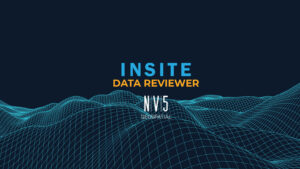
INSITE Data Reviewer provides reviewers real-time access to aerial imagery, lidar data, GIS layers, and more via the cloud to standardize quality control. This increases data validation speed and reduces the costs of geospatial projects.
Tim Saultz brings with him more than three decades of experience managing strategic programs at scale with the USGS Hollywood, Florida – 04/05/2022 – NV5
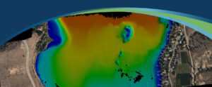
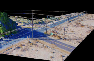
Sven Cowan, NV5 Geospatial’s Canada Program Manager, details the recent topobathy lidar project of Okanagan Basin, British Columbia, Canada in the latest issue of GoGeomatics

Today we are happy to share that the NV5 family has received four 2021 Business Achievement Awards from Environmental Business Journal (EBJ) and Climate Change


Zpryme’s Dylan Lockwood speaks with Ian Berdie, Vice President of Innovation and Development at NV5 Geospatial and LCRA’s Garret Thompson about improving outcomes via geospatial
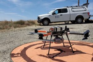
Once just an expensive toy for tech enthusiasts, drones are now being embraced in a variety of sectors to deliver tangible business benefits. For engineers,
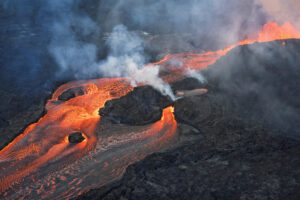
NV5 Geospatial and partner GEO1 win two awards at the 15th Annual MAPPS Awards for their lidar and image acquisition of erupting Kilauea Volcano NV5
Lidar Magazine’s Managing Editor, Stewart Walker, discusses the current and future state of lidar technology and innovation strategy with a handful of NV5 Geospatial’s technical