
NV5 Geospatial to present at AWRA
NV5 Geospatial’s Andrew Brenner and Cathy Power present at the Americaon Water Resources Association spring conference.

NV5 Geospatial’s Andrew Brenner and Cathy Power present at the Americaon Water Resources Association spring conference.

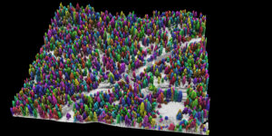
Success in Yosemite is driving the wider use of lidar surveys to support forest health and wildfire resilience, study wildlife habitats, and monitor water resources.

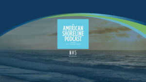
NV5 Geospatial and Geodynamics LLC, an NV5 company, experts Kurt Allen, Sloan Freeman, and Rudi Rudolph, hit The American Shoreline Podcast airwaves on Coastal News

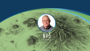
Tim Saultz brings with him more than three decades of experience managing strategic programs at scale with the USGS Hollywood, Florida – 04/05/2022 – NV5

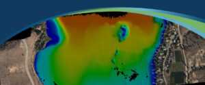
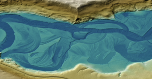
Sven Cowan, NV5 Geospatial’s Canada Program Manager, details the recent topobathy lidar project of Okanagan Basin, British Columbia, Canada in the latest issue of GoGeomatics

Today we are happy to share that the NV5 family has received four 2021 Business Achievement Awards from Environmental Business Journal (EBJ) and Climate Change


Read NV5 Geospatial’s Ian Berdie’s three trends that will reshape use of remote sensing over the next five years at GIS Lounge. “Remote” took on
Zpryme’s Dylan Lockwood speaks with Ian Berdie, Vice President of Innovation and Development at NV5 Geospatial and LCRA’s Garret Thompson about improving outcomes via geospatial

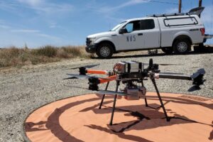
Once just an expensive toy for tech enthusiasts, drones are now being embraced in a variety of sectors to deliver tangible business benefits. For engineers,
Fill out the form below to download the handbook.
"*" indicates required fields
Please fill out the form below. After successful form submission, you will be redirected to the requested file. Thank you.
"*" indicates required fields
Our internal innovation and development team constantly analyzes new technology and develops solutions to meet our client’s challenges. Our Technically Speaking series is one way we share our technical findings with the professional community.
Please tell us a little about yourself by filling out the form below, and we’ll share the document with you, thanks!
NV5 Geospatial releases a new predictive modeling platform for vegetation management that uses existing lidar and historical data to identify the relative level of asset risk from trees by quantifying the potential for causing asset damage.
Please tell us a little about yourself by filling out the form below, and we’ll share the document with you, thanks!
Our internal innovation and development team constantly analyzes new technology and develops solutions to meet our client’s challenges. Our Technically Speaking series is one way we share our technical findings with the professional community.
Please tell us a little about yourself by filling out the form below, and we’ll share the document with you, thanks!