NV5 Geospatial/GEO1 Win 2022 MAPPS Geospatial Excellence Awards For Surveying Active Volcano
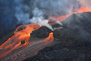
NV5 Geospatial and partner GEO1 win two awards at the 15th Annual MAPPS Awards for their lidar and image acquisition of erupting Kilauea Volcano NV5
NV5 Geospatial and partner GEO1 win two awards at the 15th Annual MAPPS Awards for their lidar and image acquisition of erupting Kilauea Volcano NV5
Lidar Magazine’s Managing Editor, Stewart Walker, discusses the current and future state of lidar technology and innovation strategy with a handful of NV5 Geospatial’s technical
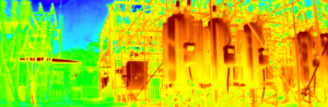
Register Webinar: The Future of Substation Inspection Feb 17th | 1 pm ET / 10am PT Explore the unlimited potential of remotely operated ground vehicles

Geo Week is right around the corner, and our team is looking forward to participating and meeting up with our peers, partners, and clients. We

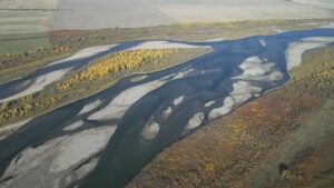
New Projects in British Columbia and Saskatchewan to Assist Agencies with Floodplain Mapping Analysis and Sustainable Water Management NV5 Geospatial, North America’s largest geospatial data
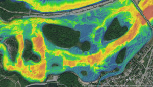
Over the past five years, the Greater Montréal Area has experienced multiple significant flooding events, which together displaced tens of thousands from their homes and
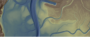
A NOAA-supported analysis of California’s Morro Bay estuary found links between seagrass collapse and later erosion that will inform bay-area adaptation strategies and could influence

In celebration of International Podcast Day, we’re sharing podcasts where NV5 Geospatial’s expertise shed light on various topics within the industry. From discussions like how
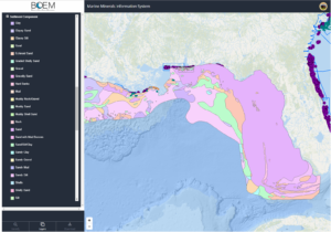
Alexa Ramirez, eGIS Project Manager for NV5 Geospatial, describes how custom eGIS applications are improving accessibility to geospatial data in an effort to improve coastal