We’re heading to the CEATI Transmission Conference
I’m excited to attend the upcoming CEATI transmission conference, and I look forward to working toward helping asset management programs improve safety, reliability, and efficiency.
I’m excited to attend the upcoming CEATI transmission conference, and I look forward to working toward helping asset management programs improve safety, reliability, and efficiency.
Quantum Spatial, Inc., the nation’s largest independent geospatial data firm will have a booth at next week’s Utility Analytics Conference in Atlanta, GA. Be sure
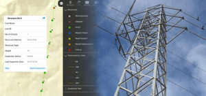
Quantum Spatial has developed a robust solution to assess suitability for siting transmission lines. We combine first-rate mapping intelligence with custom analytics and community engagement
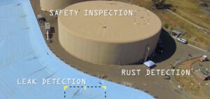
Quantum Spatial scientists have created a drone-mounted, custom sensor package that has the ability to detect underground leaks as well as other safety concerns such
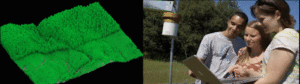
Professional scientists and students at Sonoma State University are implementing LiDAR data and other geospatial analytics to aid research and education in their environmental program.
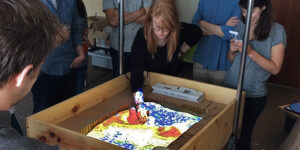
Well, if you can’t make it to the beach, bring the beach to the office. Quantum Spatial’s Willy Sercombe and Harry Zhang did just that.
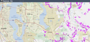
In response to the deadly Oso Landslide of 2014, government agencies have been working diligently to update landslide hazard analysis. Because LiDAR data can map
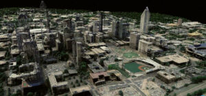
Sharita Towne, artist in residence at Newspace Center for Photography, worked with Quantum Spatial to visualize neighborhood changes using 3D LiDAR data. The final change
Many organizations, private and public, assume that the remote sensing data they need to fulfill their mission like emergency response management, natural resource planning, urban
Quantum Spatial is pleased to report that our attendance at this year’s International ISA Conference in Fort Worth, TX was a resounding success! From Sunday