HOLLYWOOD, Fla. — NV5, a global leader providing geospatial solutions, services, and software to solve mission critical challenges, today announced it has earned requalification in Esri’s Network Management specialty designation, a recognition that partners in the Esri Partner Network (EPN) can earn based on demonstrated expertise, their customer success, and[...]
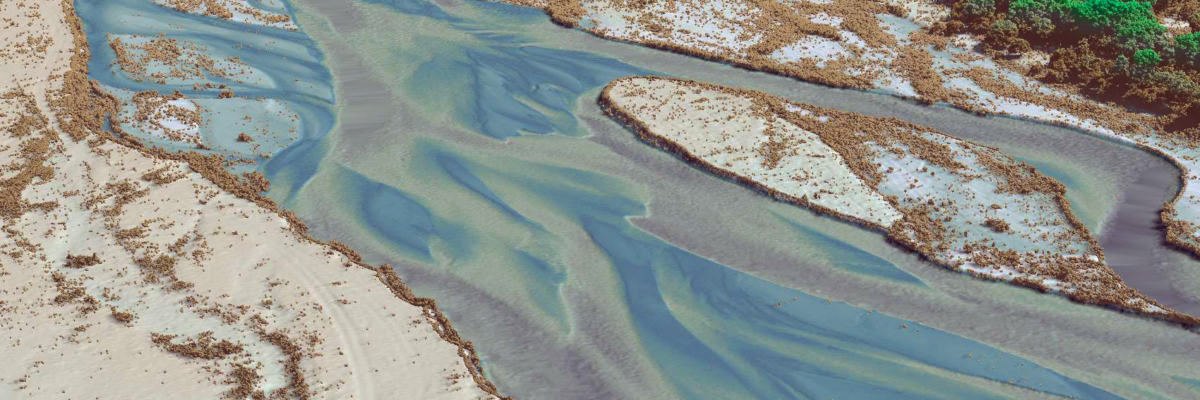
As seen in the latest issue of Hydro International Preservation of endangered species habitats along the Platte River Topobathymetric Lidar technology has become an indispensable tool in environmental management, particularly for monitoring and preserving fragile ecosystems. In central Nebraska, along the Platte River, it plays a pivotal role in ensuring[...]
The Caribbean is a region known for its vibrant culture and breathtaking landscapes. However, it is also particularly vulnerable to the impacts of climate change. Its small island nations are highly susceptible to natural disasters, such as hurricanes and floods, which are becoming more frequent and severe due to global[...]
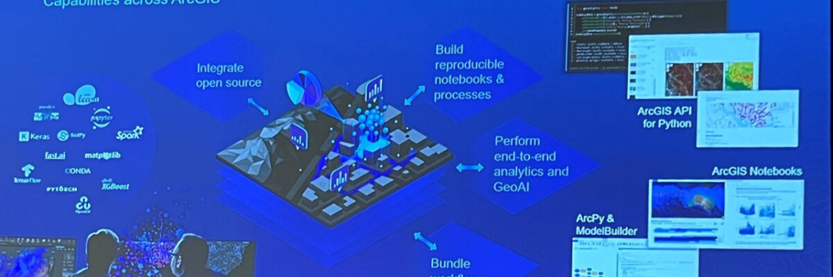
We’re recapping the 2024 Esri Developer Summit with insights from the event earlier this month on product updates, new technology, emerging trends, and other big news in the Esri world. From ArcGIS Knowledge to AI to APIs, we asked a few of our attendees to share their biggest takeaways from[...]
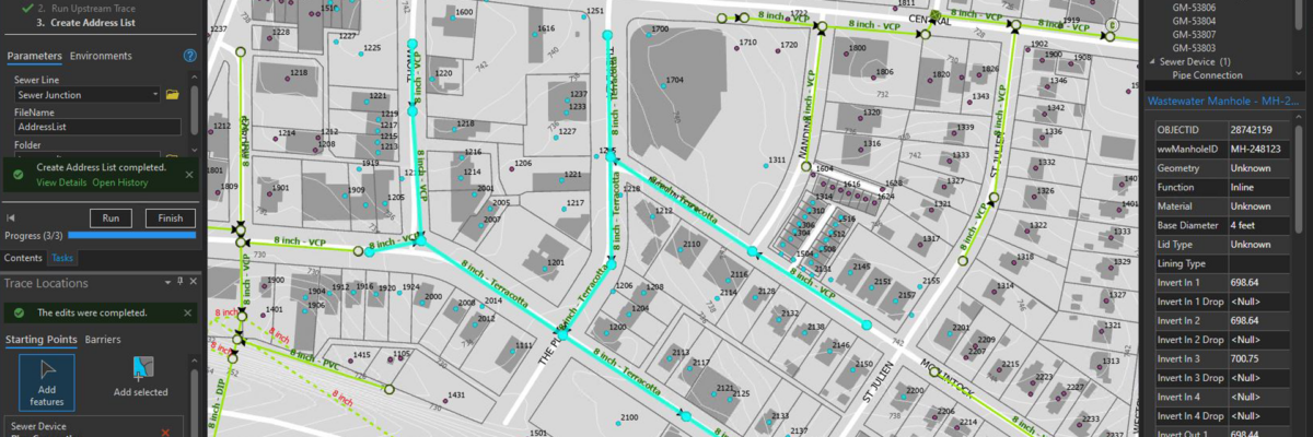
Located in the Seattle metropolitan area on an island in the southern portion of Lake Washington, Mercer Island has a population of over 25,000 residents. The City’s water utilities systems rely on geospatial technology to provide data to City users for operations, maintenance planned repairs and upgrades, and as a[...]
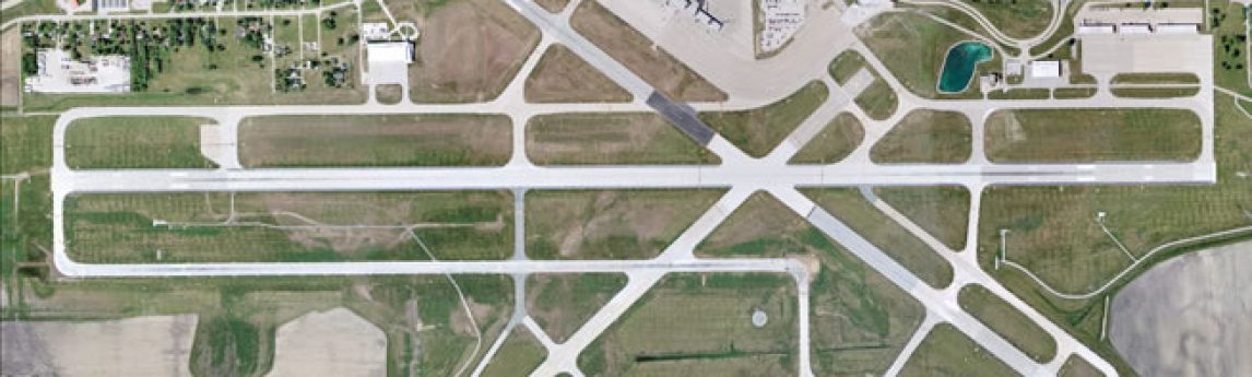
Single partner for combining engineering-grade data acquisition with geospatial analytics and solutions to support operational business decisions at airports HOLLYWOOD, Fla., August 22, 2023 – NV5 Geospatial, North America’s most comprehensive geospatial data firm, today announced the ability to provide a complete solution for airports combining acquisition services, mapping and[...]
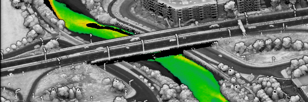
CMQuébec contracted NV5 to collect the topobathymetric Lidar data during leaf-on conditions for an area of interest containing eight rivers surrounding Québec City. The community and NV5 worked together collaboratively in order to prepare an effective flight plan. CMQuébec drew on the experience from its previous topobathymetric Lidar survey, as[...]
The Navy Shore Geospatial Energy Module (NSGEM) is an interactive web map and reporting tool that provides the Navy with a standardized, transparent view of authoritative energy consumption data and metrics. NSGEM integrates a variety of data from authoritative sources, including real property, consumption data, NOAA weather data, and others.Initially[...]
Deploying the appropriate marine vessel is essential when locating and assessing suitable offshore wind sites. Learn how NV5 Geospatial utilizes their dedicated fleet to perform deep sea and nearshore bathymetric survey in the latest issue of Ocean News & Technology “Activity is heating up along the nation’s coastlines as the[...]
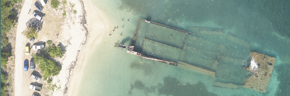
Task Order Features Unique Survey Approach to Deliver Valuable Charting Data that Will Also Support Environmental and Coastal Resilience Efforts Geodynamics, an NV5 company, North America’s most comprehensive geospatial data provider, has undertaken one of the largest surveys of shallow complex environments under a dual purpose task order from the[...]
Form #2 - Sends email containing the link to the PDF
"*" indicates required fields
eNewsletter - NV5 Real Estate Transaction Services
Contact NV5 Real Estate Transaction Services
Download NV5 2022 Compliance Calendar
Please fill out the form below. After successful form submission, you will be redirected to the requested file. Thank you.
"*" indicates required fields
Hyperspectral Imaging - Technically Speaking
Our internal innovation and development team constantly analyzes new technology and develops solutions to meet our client’s challenges. Our Technically Speaking series is one way we share our technical findings with the professional community.
Please tell us a little about yourself by filling out the form below, and we’ll share the document with you, thanks!
Accuracy Part 1- Technically Speaking
Our internal innovation and development team constantly analyzes new technology and develops solutions to meet our client’s challenges. Our Technically Speaking series is one way we share our technical findings with the professional community.
Please tell us a little about yourself by filling out the form below, and we’ll share the document with you, thanks!
Prune Optimization Webinar Recording
NV5 Geospatial releases a new predictive modeling platform for vegetation management that uses existing lidar and historical data to identify the relative level of asset risk from trees by quantifying the potential for causing asset damage.
Please tell us a little about yourself by filling out the form below, and we’ll share the document with you, thanks!
Topobathy Lidar - Technically Speaking
Our internal innovation and development team constantly analyzes new technology and develops solutions to meet our client’s challenges. Our Technically Speaking series is one way we share our technical findings with the professional community.
Please tell us a little about yourself by filling out the form below, and we’ll share the document with you, thanks!