
Hydrographic
Discover what lies beneath
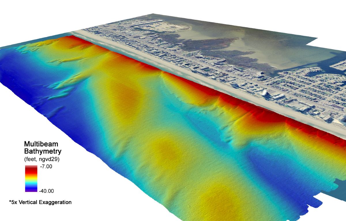
Marine survey
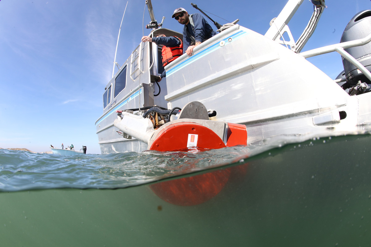
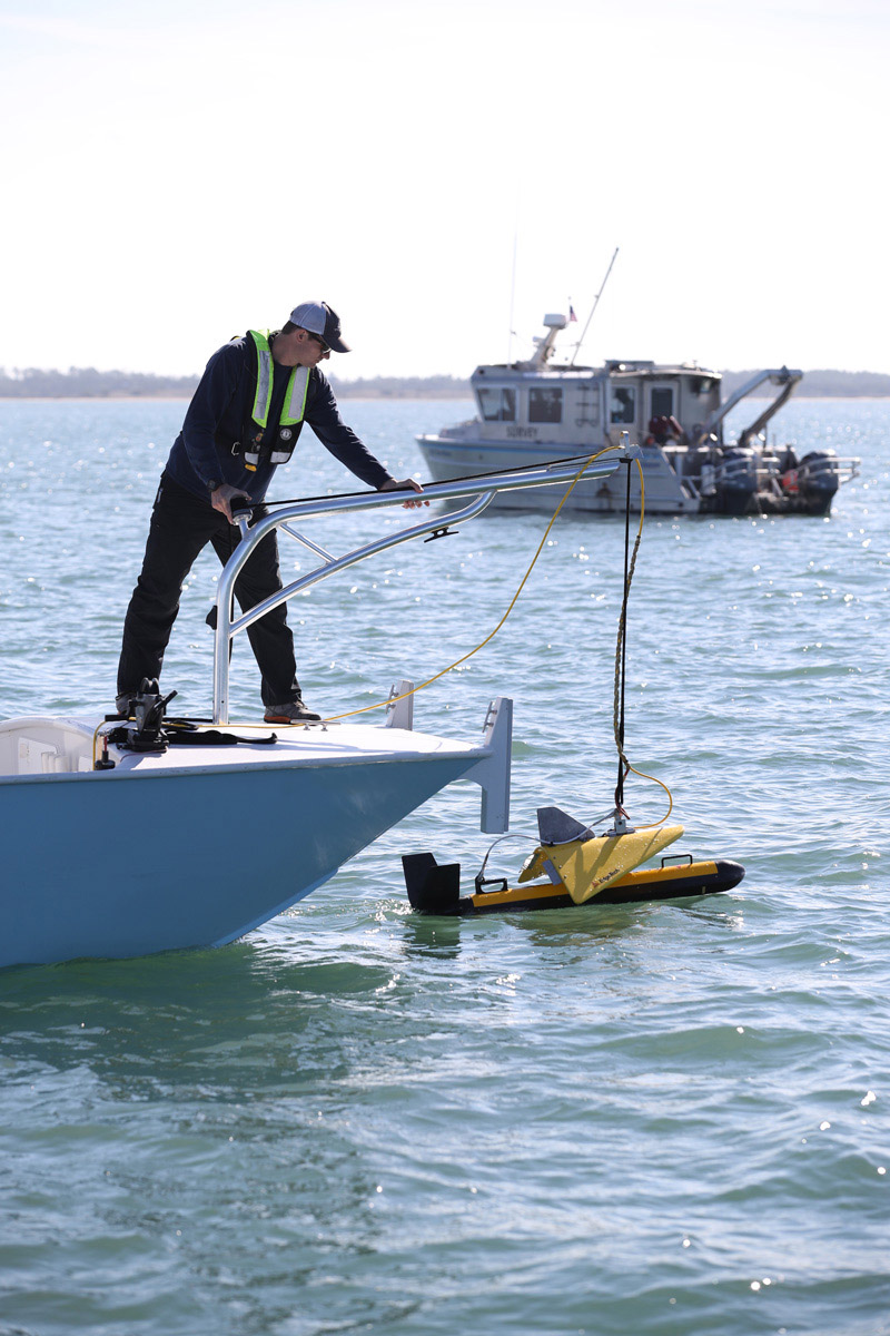
NV5 specializes in hydrographic survey using multibeam and singlebeam sonar with inertially-aided positioning. Our hydrographic expertise includes the most challenging of aquatic environments from shallowest inland waters to the deep ocean.
Coastal Resilience
We deliver detailed and actionable data on coastal mapping including potential sediment borrow areas using a systematic and cost-effective approach based on decades of experience.
Offshore Wind
NV5 is a leader in offshore wind survey, including specialized experience in coastal zone waters where conditions are dynamic. NV5 is one of only 2 contractors capable of both hydrographic surveys and shallow water bathymetric lidar surveys.
Not All Boats are Created Equal – The Importance of Dedicated Marine Survey Vessels for Offshore Wind Siting
Deploying the appropriate marine vessel is essential when locating and assessing suitable offshore wind sites. Learn how NV5 Geospatial utilizes their dedicated fleet to perform. Learn more
NOAA Selects Geodynamics for Extensive Hydrographic Survey in North Carolina
Task Order Features Unique Survey Approach to Deliver Valuable Charting Data that Will Also Support Environmental and Coastal Resilience Efforts. Learn more
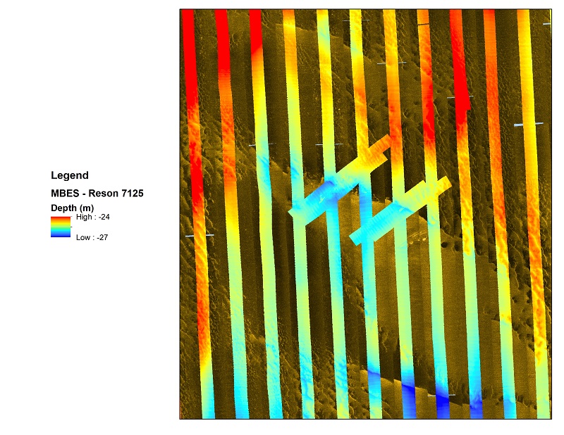
Multi-Beam Echosounder
Multibeam echosounder
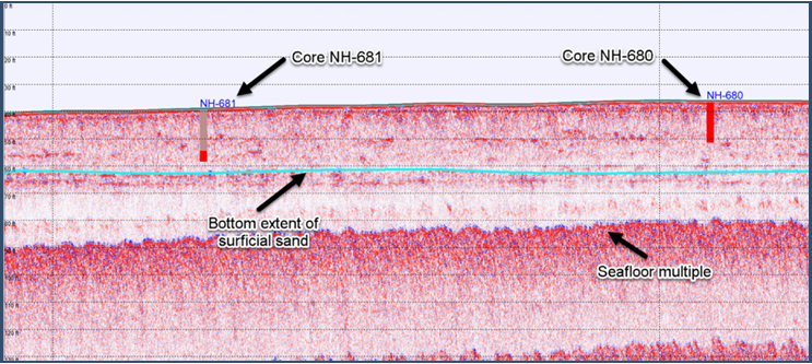
Sub bottom Profiler
Sub bottom profiler
side scan sonar
side scan sonar
Transverse Gradiometer
Transverse Gradiometer
Contact Us
Shoreline Mapping and Topographic Survey
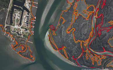
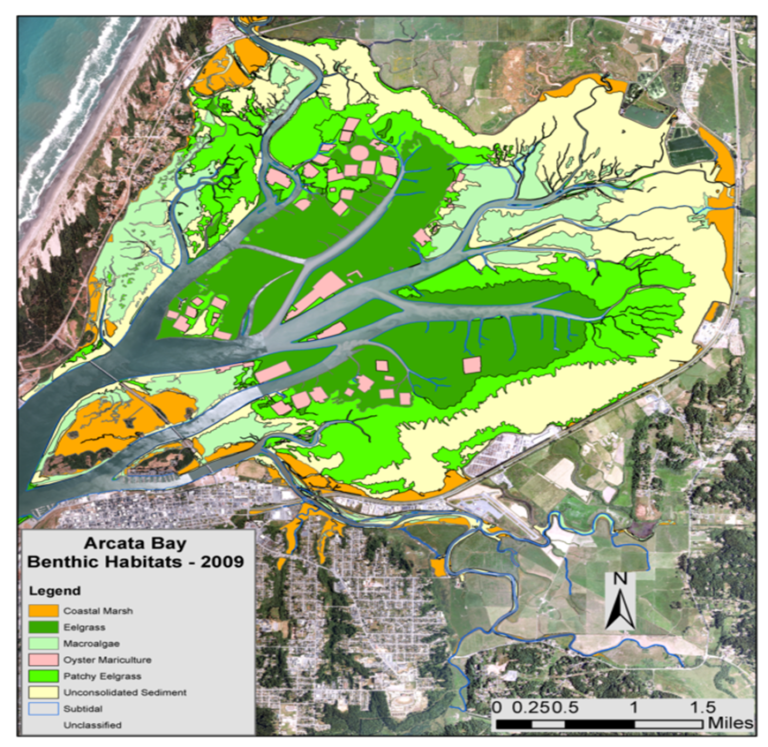
Benthic Habitat Mapping
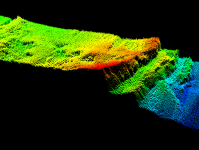
Hydrographic Sonar
Hydrology, Hydraulics, and Inundation
Geophysical Analysis
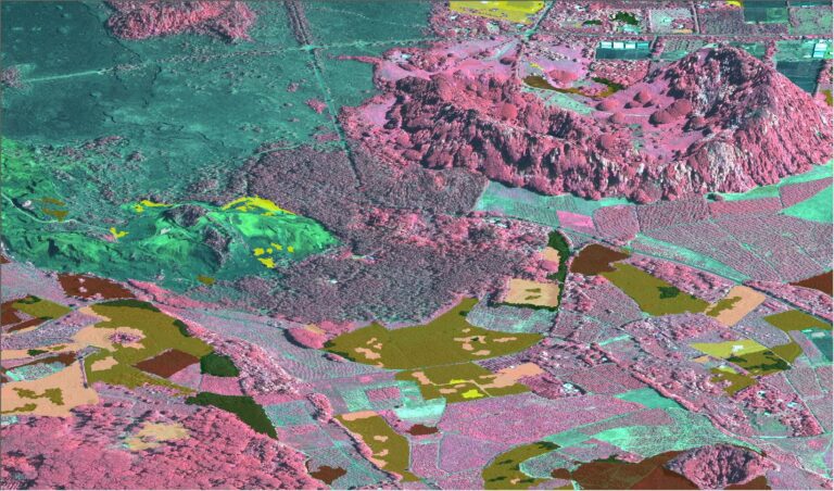
Coastal Land Cover and Change Analysis
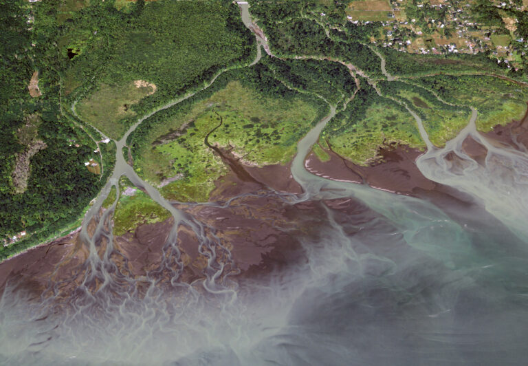
Geodynamics and NV5 Geospatial has been at the forefront of collecting and processing high-resolution lidar and orthoimagery for coastal and marine resource programs for over four decades, offering experience in acquiring data with close attention to tides, water clarity, airspace restrictions, and weather patterns to ensure success. We also offer integrated GIS solutions to harness data into actionable information. Guided by coastal geospatial experts, our data products, analytics, and enterprise GIS solutions inform resource management, habitat mapping, and coastal resiliency planning for future generations.
Shoreline Mapping and Topographic Survey
Using topobathymetric lidar, processing algorithms, feature extraction, and photogrammetric tools, we model shoreline topography, map the land water interface, and depict coastal features with high detail and accuracy for effective nautical charting, resource management, urban development, land management, infrastructure maintenance, and emergency response. View some of our Topographic projects here.
Benthic Habitat Mapping
From topobathymetric lidar data and innovative processing tools, we can classify benthic and submerged environments (seagrass, kelp beds, algae, coral reefs) to identify critical habitat for marine species and facilitate effective resource management. Our radiometric calibration of lidar intensities is a significant contributor to mapping the underwater environment and sea floor.
Hydrographic
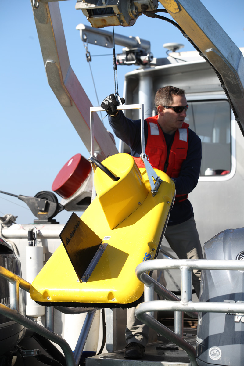
NV5G Hydrospatial specializes in hydrographic survey using multibeam and singlebeam sonar with inertially-aided positioning. Our hydrographic expertise includes the most challenging of aquatic environments from shallowest inland waters to the deep ocean. Using our fleet of calibrated survey vessels or aboard ships offshore, we provide our clients with high resolution bathymetric, acoustic backscatter, and water column data that strictly adhere to the highest IHO, USACE and NOAA charting standards. View some of our Hydrographic projects here.
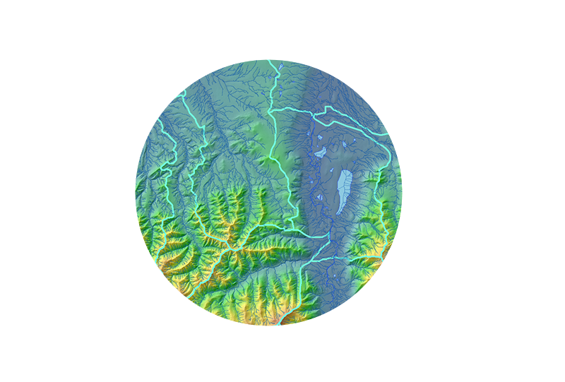
Hydrology, Hydraulics, and Inundation
High-resolution lidar data improves flood hazard maps; predictive flood, storm surge, and tsunami inundation maps; and hydrologic and hydraulic modeling within coastal catchments. Our data is advancing coastal intelligence and resiliency to better protect and prepare communities and shoreline resources in a dynamic coastal environment.
Geophysical
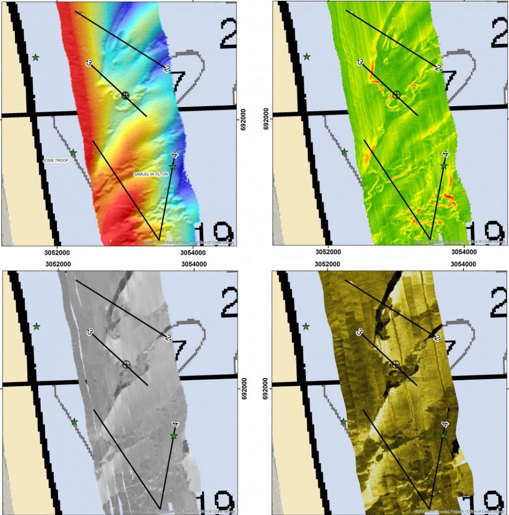
Our geophysical surveys explore all dimensions of the seabed using the latest technologies and modern expertise. Using precisely positioned magnetometers, sub-bottom and sidescan sonar to image the seabed surface and sub-surface, NV5G Hydrospatial can delineate natural resource and habitat boundaries or identify and precisely position hazards to navigation such as pipelines, hurricane debris, unexploded ordinance, and ship wrecks or other cultural resources. View some of our Geophysical projects here.
eGIS
We have delivered marine eGIS solutions to serve as decision support tools for managing marine minerals, improving sea turtle safety, and mapping essential fish habitat, and we have updated environmental sensitivity index (ESI) maps for a number of states to ensure oil spill response preparedness. Visit our eGIS page to learn more.
Geospatial Data Solutions
Our geophysical surveys explore all dimensions of the seabed using the latest technologies and modern expertise. Using precisely positioned magnetometers, sub-bottom and sidescan sonar to image the seabed surface and sub-surface, NV5G Hydrospatial can delineate natural resource and habitat boundaries or identify and precisely position hazards to navigation such as pipelines, hurricane debris, unexploded ordinance, and ship wrecks or other cultural resources.
Coastal Land Cover & Change Analysis
With the aid of recurring surveys and temporal comparisons, our trend analyses quantify, model, and visualize important changes taking place along coastal environments. Detecting and quantifying these patterns empowers planners and resource managers to accurately evaluate, respond, monitor, predict or mitigate change, improving knowledge and enhancing preparedness.
Mobile Laser Scanning
Our geophysical surveys explore all dimensions of the seabed using the latest technologies and modern expertise. Using precisely positioned magnetometers, sub-bottom and sidescan sonar to image the seabed surface and sub-surface, NV5G Hydrospatial can delineate natural resource and habitat boundaries or identify and precisely position hazards to navigation such as pipelines, hurricane debris, unexploded ordinance, and ship wrecks or other cultural resources.
Our geophysical surveys explore all dimensions of the seabed using the latest technologies and modern expertise. Using precisely positioned magnetometers, sub-bottom and sidescan sonar to image the seabed surface and sub-surface, NV5G Hydrospatial can delineate natural resource and habitat boundaries or identify and precisely position hazards to navigation such as pipelines, hurricane debris, unexploded ordinance, and ship wrecks or other cultural resources.
Updated National Hydrography Dataset (NHD)
Combining models of vegetation structure with hydrologic models aids in understanding how terrain and vegetation affects water movement throughout a watershed. We have developed a lidar-driven methodology to update the National Hydrography Dataset (NHD) and improve hydrologic flow modeling and stream network maps for coastal watersheds.