Hydrospatial Projects
Hydrographic
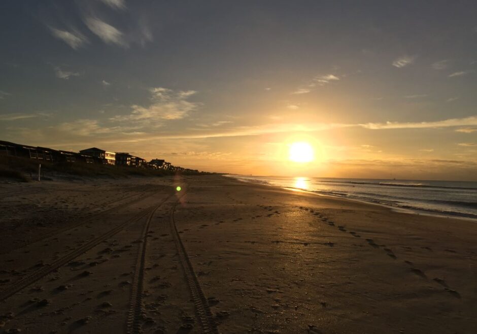
Wilmington Harbor & Beach Surveys
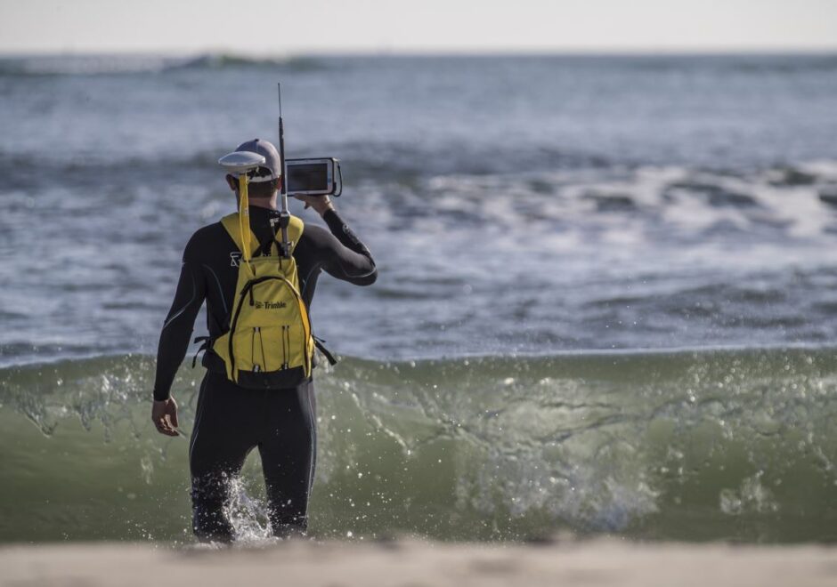
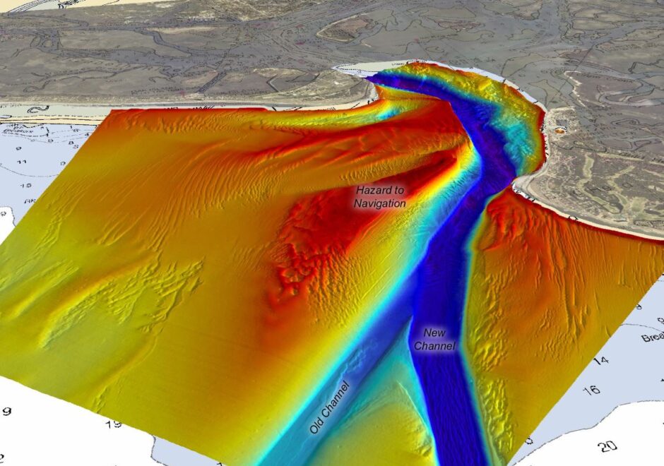
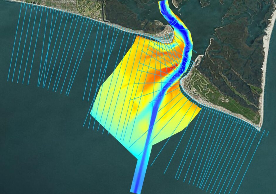
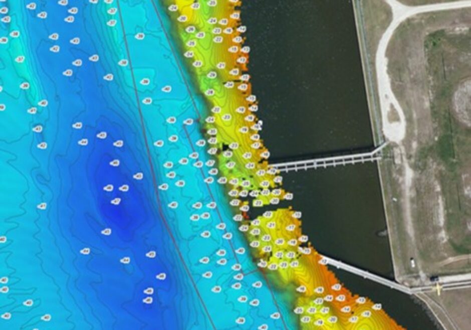
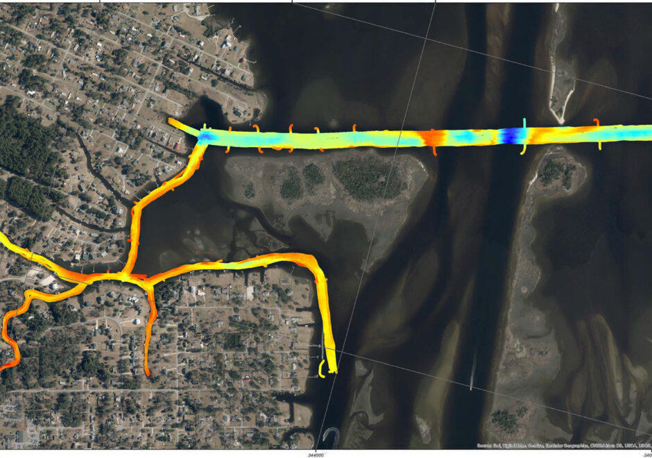
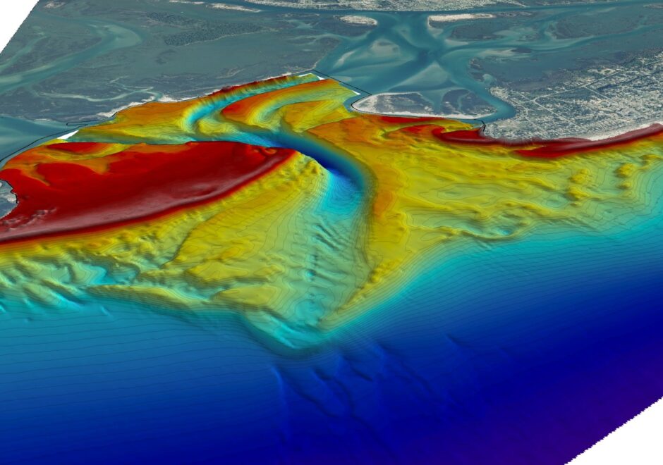
Over a large area with complex and dynamic shallow water regions, Hydrospatial performed high-resolution multibeam, singlebeam, and topographic surveys of the Cape Fear River Inlet and adjoining shorelines in order to generate a highly accurate Digital Elevation Model for sediment management purposes. Under contract with the US Army Corps of Engineers Wilmington District, Hydrospatial was issued repetitive task orders to complete shoreline and inlet monitoring from 2014-2016.
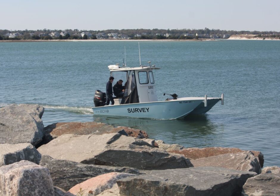
To monitor the Wilmington Harbor Navigation Project, Hydrospatial completed a multibeam survey of 7.6 miles of the navigation channel and ~3.5 miles in width of the ebb shoal complexes using a Kongsberg EM3002-D aboard survey vessel R/V Benthos each winter. This multibeam bathymetry was collected in and around the shipping channels and ebb shoals of Cape Fear River Inlet with the goal of producing a complete, interpolated bathymetric surface capable of generating continuous contours. Areas too shallow for multibeam were mapped using a singlebeam system and topographic survey techniques.
This survey met or exceeded the criteria for Class 1 Hydrographic Surveys as outlined in the USACE Hydrographic Surveying Manual and Hydrographic Surveying Engineering Circular. The multibeam survey was collected concurrently with adjacent seamless topo-bathy beach profiles collected along pre-defined USACE monitoring profiles on Oak Island and Bald Head Island. Topobathy beach profiles were collected again on the same stations each summer, to monitor seasonal sediment erosion and accretion patterns.
The USACE Wilmington District has rated Hydrospatial’s performance of both tasks as “Exceptional” with regard to Schedule, Cost Control, Management, and Regulatory Compliance.
NOAA Chicago Surveys
Project Description Here.
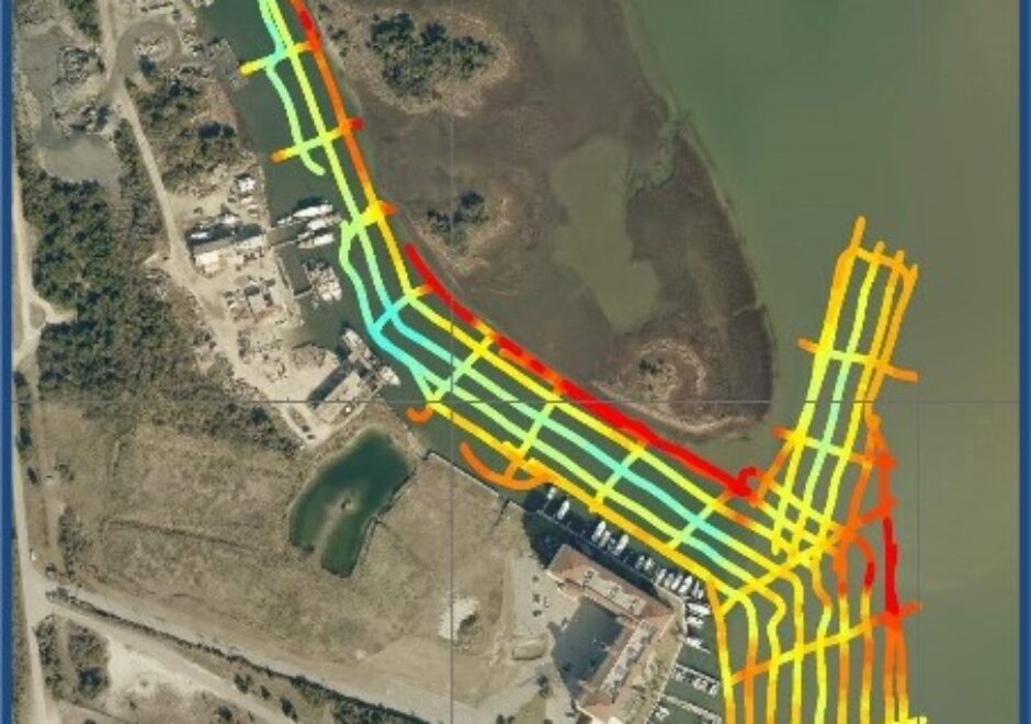
On Call Hydrographic Surveys of the North Carolina State Port
Hydrospatial provides hydrographic surveys within the Port of Morehead City under an on-call professional services agreement. NV5 Hydrospatial is pre-qualified by the NC Department of Transportation to complete hydrographic surveys, including at all NC State Ports.
Hydrospatial has performed multibeam sonar surveys in support of dredging at both the T-Pier fuel docks and the northern Barge Berths. During each of the dredging cycles, Hydrospatial performed before dredge (BD) and after dredge (AD) surveys to assess the success of the dredging and quantify the material removed. Hydrospatial worked directly with the dredge contractors to provide vertical control for the dredging operations and provided detailed reviews of regions to be dredges, including estimated material quantities. Using HYPACK, we developed advanced channel plans that were used in the determination of material to be removed and the final material actually removed. Following these surveys a full survey report containing procedures, results, charts and Quality Assurance / Quality Control documentation was provided immediately.
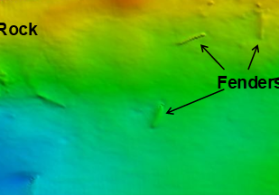
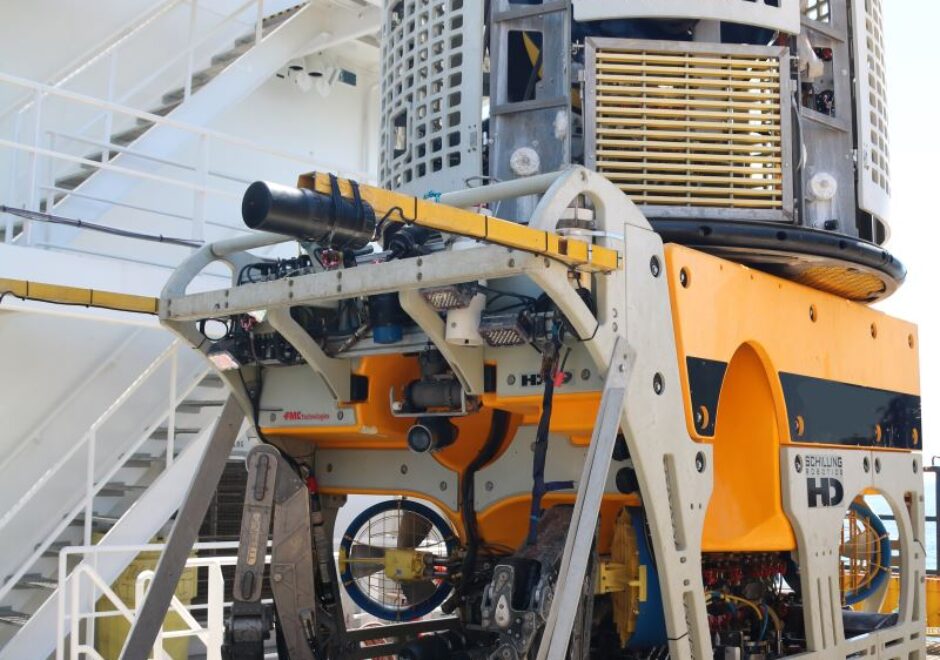
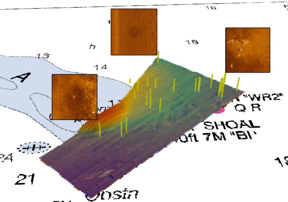
In addition to our dredging support surveys, Hydrospatial has performed high resolution object detection surveys at the Morehead City State Port. Hydrospatial was tasked with identifying the location of fenders that are now submerged around the port walls. For this survey, we utilized a dual head Kongsberg EM 2040 C withprecise position and attitude information from the IARTK POS MV 320 v5. In addition to finding numerous fenders on the seabed, the surveyed also identified other objects such as tires, rocks and pipes.
Geophysical
Hydrographic & Geophysical Survey of Offshore Sediment Resource Borrow Area
Hydrospatial was contracted by the USACE Wilmington District to perform hydrographic and geophysical surveys within a designated borrow area offshore Kure Beach, North Carolina. Data was collected for the purposes of identifying and mapping the top and bottom elevations of potential sand sources for beach fill projects. The survey employed multibeam sonar and bathymetric lidar to identify seafloor elevations and sub-sea sediment horizons.
Survey efforts were conducted aboard the R/V Benthos, a 30’ dedicated survey vessel with a fixed-mount dual-head multibeam and A-frame winch for towed array. Data deliverables included a 5ft resolution bathymetric grid with 1ft contours and 1ft resolution backscatter intensity grid, imagery of sub-bottom profiles (imprinted with existing cores and digitized reflectors), attachment-enabled navigation lines, and isopach grids (65ft resolution) depicting sediment thickness within the survey area. The client rated this task as exceptional with the following comment, “The contractor worked his field schedule around adverse weather conditions, a treacherous coastal inlet, and limited daylight hours to deliver a high quality product earlier than the required delivery date”.
Hydrographic & Geophysical Surveys to Support Shore to Shelf Cable Burial
Hydrospatial was contracted by L3 MariPro, Inc. to provide hydrographic and geophysical surveys and analysis as part of the design, fabrication and installation of the Undersea Warfare Training Range (USWTR) in the Atlantic Ocean. Located offshore of Jacksonville, FL, the USWTR tracking range consists of several strings of listening nodes on the seabed. To mitigate the risk of interaction with fishing gear, range cabling was buried as much as possible while avoiding hardbottom substrate and areas identified as Essential Fish Habitat or of potential archaeological significance.
We designed and implemented hydrographic and geophysical surveys of the proposed trunk cable route using a Kongsberg EM2040 multibeam, an Edgetech 2000 combined sidescan and sub-bottom sonar towfish, and a SeaSPY 2 marine magnetometer with precise positioning provided through iXBlue USBL transceiver and an Applanix POS-MV 320 inertial motion unit. Data was acquired aboard the UNOLS vessel R/V Savannah to describe general seabed morphology and bathymetry along the proposed route. This identified any seabed features that may have an impact on the laying and plough burial of the trunk cable. Hydrospatial also provided identification and precise positioning of all natural and manmade obstructions in the vicinity of the proposed cable route and node sites.
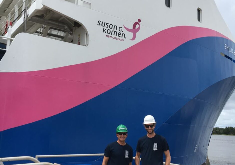
In a follow-on effort, Hydrospatial designed and led an ROV survey to assess and measure the extent of cable burial following construction. Aboard the M/V Shelia Bordelon, an inspection-class ROV collected high-definition video of selected portions of the trunk cable. In addition to standard survey deliverables reporting, Geodynamics also integrated a Full Motion Video (FMV) into a GIS database, allowing data-driven documentation and analysis of the acquired ROV inspection data.
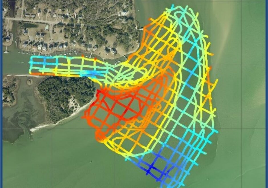
Oyster Bed Multibeam & Sidescan Sonar Surveys
Hydrospatial was contracted to conduct high-resolution hydrographic surveys of the seafloor at four proposed oyster sanctuary sites in the Pamlico Sound, NC. Prior to the placement of any oyster reef material at each proposed site, each location was surveyed to determine the presence or absence of existing structure, identify potential submerged cultural sites, and to delineate Submerged Aquatic Vegetation (SAV). To ensure the appropriate placement of reef making material, we also collected the water depths at each site and identified the bottom substrate.
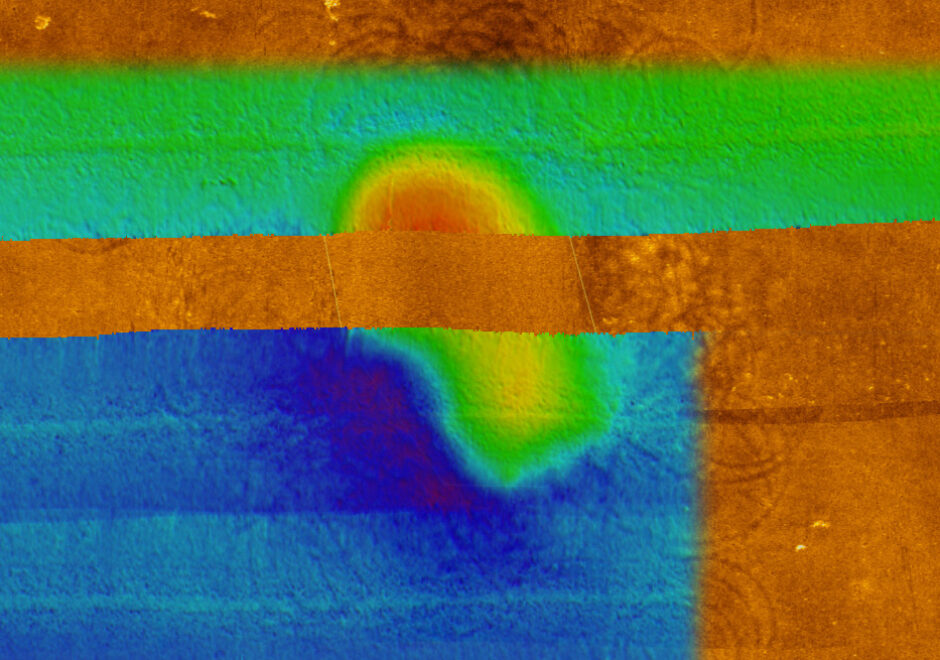
Both multibeam and sidescan sonar data were collected in order to accurately assess the seafloor of ~3,000 acres of proposed oyster sanctuary with depths ranging from 6ft to 20ft. Multibeam data was collected using a Kongsberg EM3002-D dual-head system in accordance with USACE standards for navigation and dredging requirements to provide accurate seafloor elevations. Sidescan data was collected using an Edgetech 4200-HD towfish. Although there are no available NOAA tide zone files available for this area, a separation model was acquired from NOAA to accurately transform the ellipsoid heights to Chart Datum MLLW. To appropriately use this separation model, the Applanix POS-MV data was post-processed in POSPac to incorporate GPS tides; the health and status of the NC CORS network for the nearest base stations were monitored daily.
Mobile Laser Scanning
Mobile Lidar and Hydrographic Streambank Survey
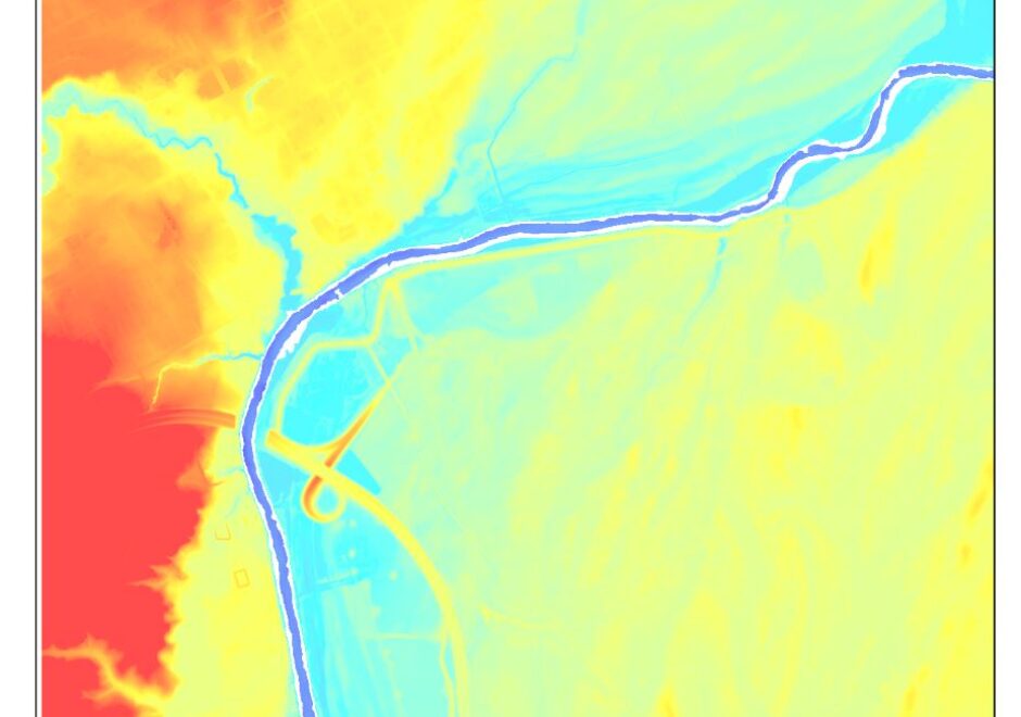
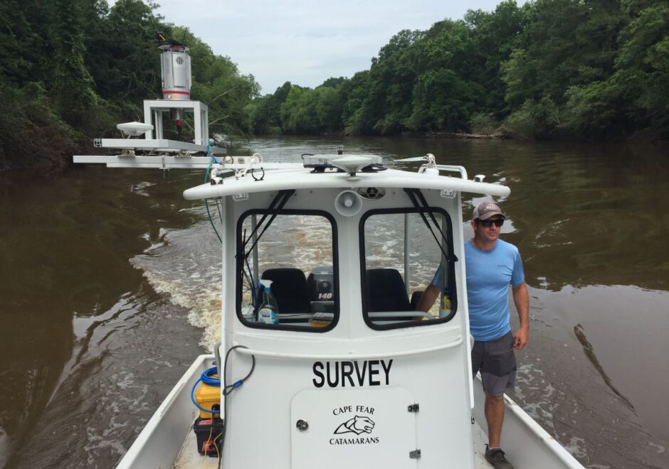
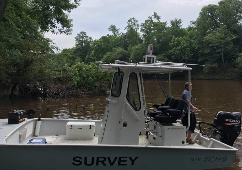
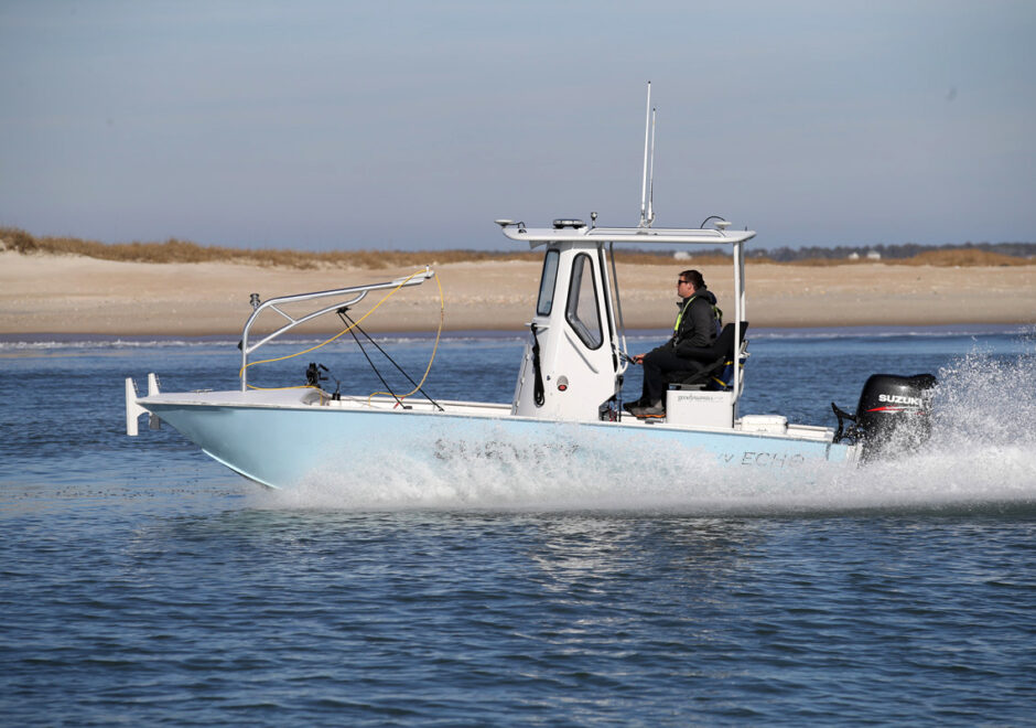
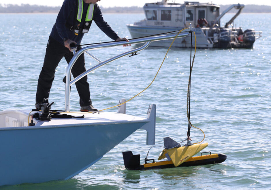
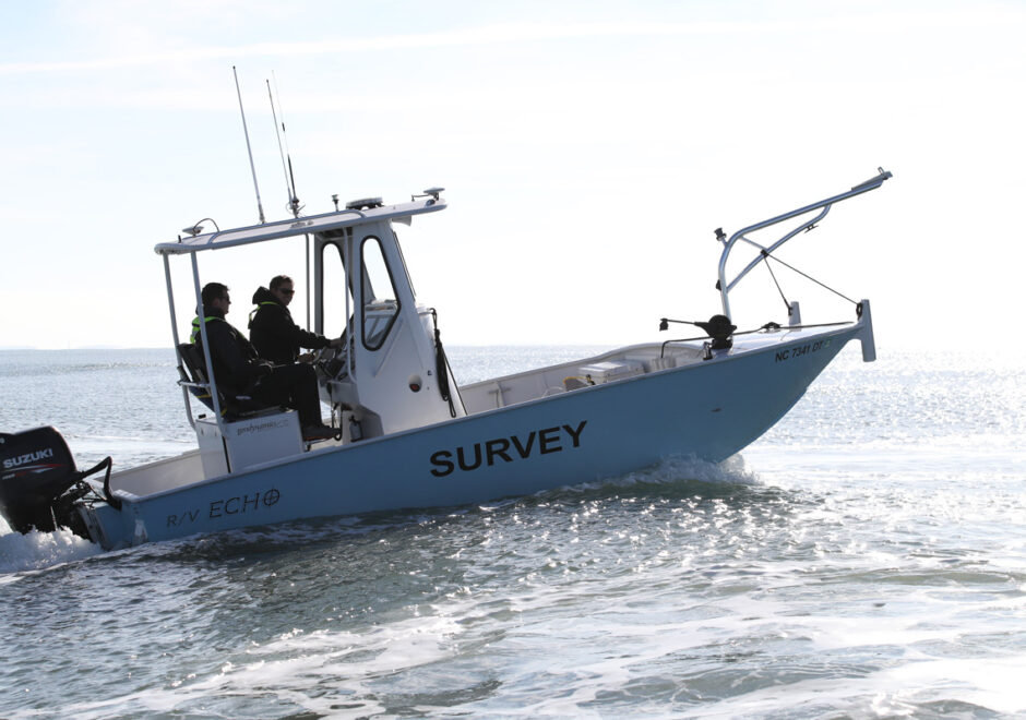
Hydrospatial mapped a six-mile portion of the Tar River using a Riegl mobile laser scanner and an Odom singlebeam sonar. Both systems were mobilized on the shallow-water custom survey vessel R/V Echo with RTK-GPS positioning and an Applanix POS-MV inertial motion sensor. Elevations and soundings were collected along transects and cross sections. Real-time data mobile laser scanning data was collected simultaneously with singlebeam data; the laser scanner was mounted on the outside starboard side of the vessel to scan the full vertical field of view.
Data processing included Hypack to integrate raw soundings with correctors, QPS QINSy and Qimera to integrate mobile laser scanner components, edit, and visualize the data in 2D and 3D, and Surfer for gridding into a Digital Elevation Model.
This seamless topobathy streambank survey provided the client with an accurate basemap for hydraulic modeling and civil engineering. In addition, the precise positioning and documented QA-QC methodology will support repeatable surveys that are capable of identifying changes in the streambank in the future.
Wallops Island Shoreline Mapping Program
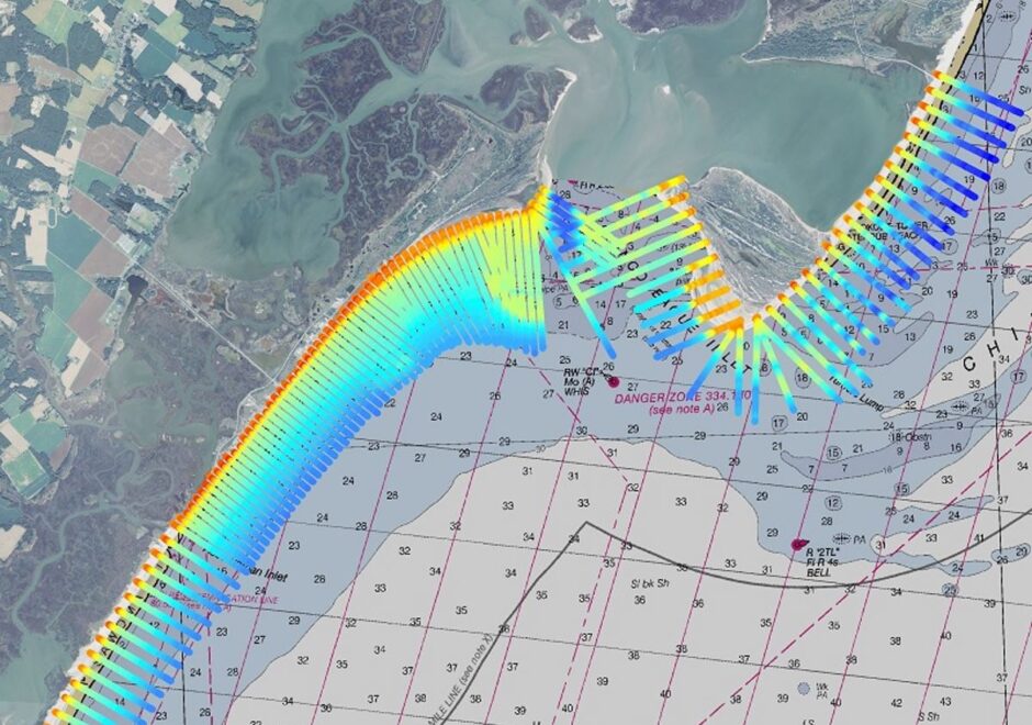
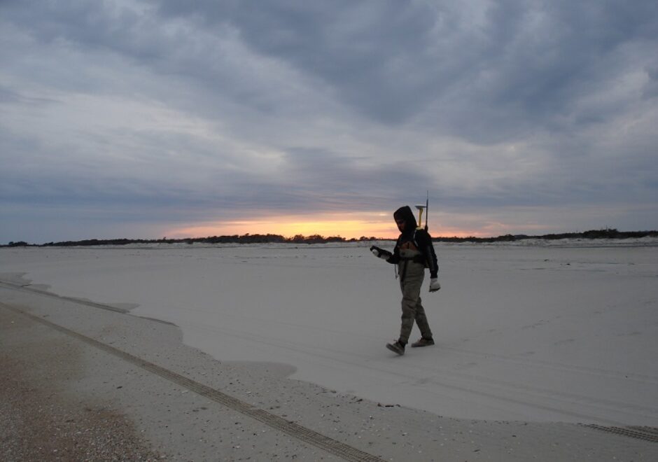
Hydrospatial leads a semi-annual beach monitoring program to survey the coastline adjacent to the NASA Wallops Flight Facility following a $2B beach nourishment and seawall rehabilitation effort. The field work consists of topographic, hydrographic, and airborne lidar and digital orthoimagery surveys.
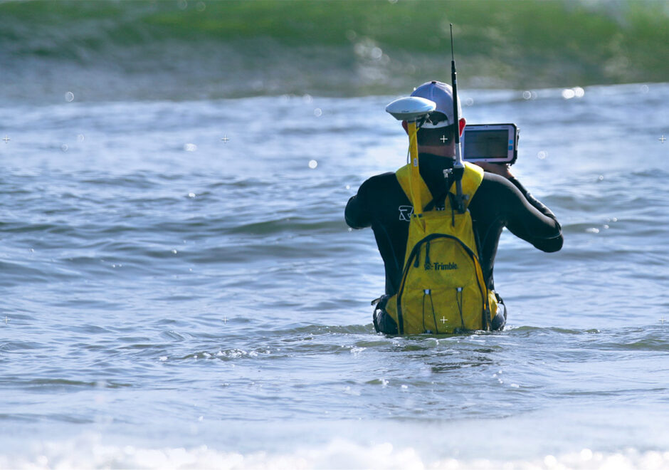
Seamless topobathy beach profiles are collected for the Wallops Island engineered beach project area twice per year, while including an extended monitoring area to the north and south annually. Survey operations are dictated by NASA rocket / UAV launch schedules, various security limitations and acquired across extremely dangerous shoals and underwater navigational hazards. Accurate change data is captured across the entire profile, especially offshore where large volumes of sand movement are observed in this beach environment. Topographic data collection utilizes RTK-GPS with innovative shore parallel tie-lines; singlebeam hydrographic data is collected using an Odom CV-100 and Applanix POS-WM inertial motion unit with a custom shallow water survey vessel that achieves overlap between the topographic and hydrographic data with no swimming.
The primary purpose of the beach monitoring is to determine the condition of the beach, measure volumetric rates of erosion and accretion, track the movement of sand in the longshore and cross-shore direction by comparative surveys, and compare beach conditions from one reach to another for purposes of evaluating beach nourishment and other restoration efforts.
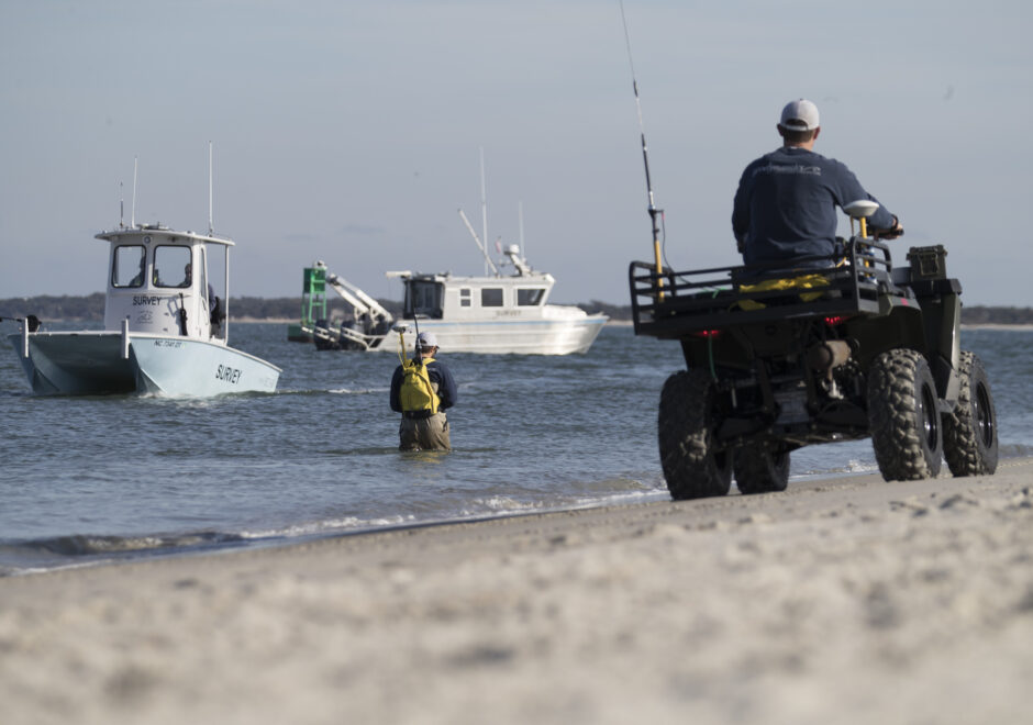
Masonboro Inlet Jetty Survey with Simultaneous Mobile Laser, Singlebeam & Multibeam Sonar
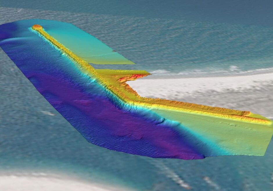
Hydrospatial was contracted to perform a comprehensive topobathy survey of the Masonboro Inlet south jetty in New Hanover County, NC. This work included mapping both the sub-aqueous and sub-aerial portions of the rock jetty, as well as the inlet complex adjacent to the hard structure. This work was performed using a high-resolution multibeam sonar (Kongsberg EM3002-D), a mobile laser scanner (Dynascan M250 Lidar) mounted on both topographic and marine platforms, and singlebeam sonar (Odom CV100) soundings. All geographic data was corrected with RTK-GPS corrections provided by the NC Geodetic Survey’s CORS network.
The multibeam bathymetry data was collected in accordance with IHO Special Order and USACE standards for navigation and dredging requirements to provide accurate depths and detailed information on morphology. All laser scanning practices were performed following a complete calibration of antenna separation, sensor alignment, and ambiguities on a single mounting platform that was exchanged between marine and topographic platforms. All equipment preparations and survey operations were performed with rigorous QA/QC practices to provide reliable data.
XYZ point files from all three data sources were then merged into a single file and viewed in a point cloud viewer to analyze overlap, data coverage, and elevation consistency. Overlapping portions of data were cleaned to enhance the quality of the final data. The dataset was then modeled in various ways so that the end user would have flexibility when analyzing the data and using various software, including final deliverables in inRoads (DTM and DGN) and a Digital Elevation Model (DEM).
Topographic
Topobathy Surveys to Assess Beach Replenishment
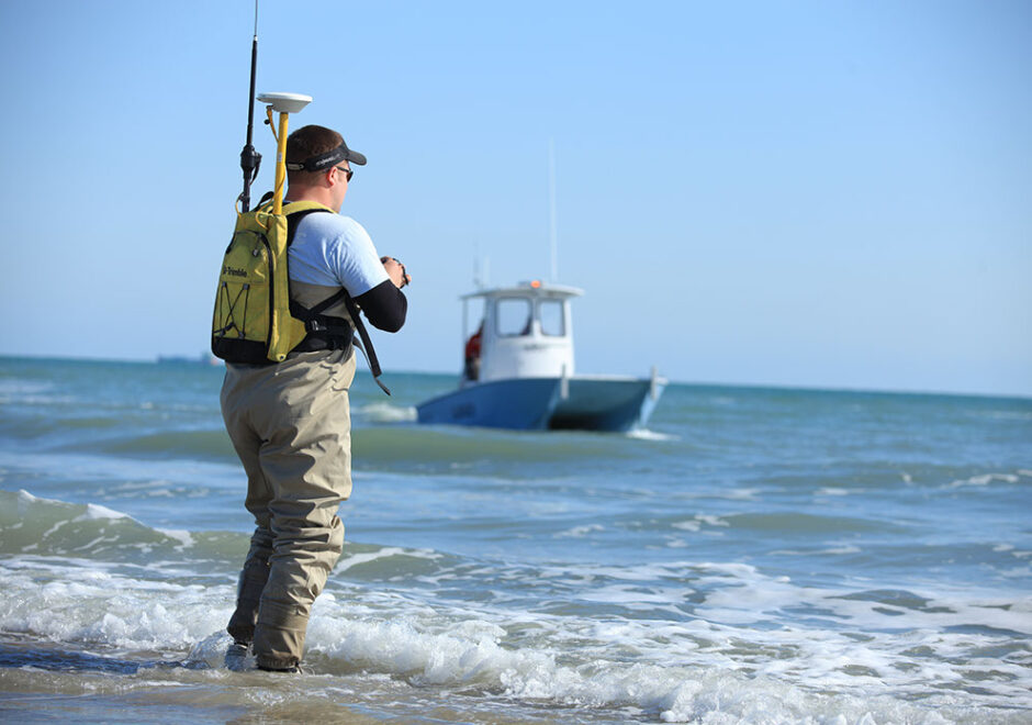
The Carteret County beach towns of Pine Knoll Shores and Emerald Isle, in conjunction with the Carteret County Shore Protection Office, received funding to replace sand lost from a beach renourishment project due to Hurricane Irene. Hydrospatial performed a rapid response beach and hydrographic survey immediately following the hurricane to quantify sand losses attributable to Irene and thereby satisfy FEMA requirements for reimbursement.
To support beach replenishment efforts, Hydrospatial first provided a pre-construction hydrographic survey of the borrow area and geo-referenced photo and video of the beach sections. With three hopper dredges bringing material to the beach concurrently, Hydrospatial conducted before-dredge, after-dredge, and conditional topographic and hydrographic surveys to document beach fill volumes which were critical to assessing project progress.
In addition to providing project survey control throughout the project, Hydrospatial also assisted with grade stake set and logging, and collected Mean High Water contour surveys. Following completion of construction, a multibeam hydrographic survey of the borrow area was completed to assess the volume of sediment removed. Aerial photographs were collected during and following construction to assess beach fill.
Shallow Draft Navigation Waterway Surveys
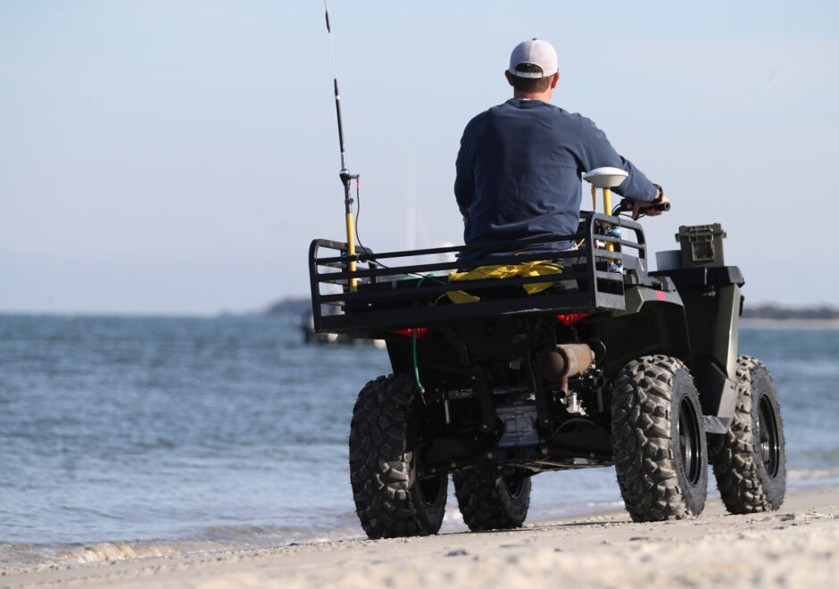
Hydrospatial completed six singlebeam hydrographic and topographic surveys in support of design and permitting work for channel dredging projects in Carteret County, NC. Each of these channels had been identified by the county as occasionally or chronically impassible to recreational and/or commercial vessel traffic. Hydrospatial’s surveys assisted the client in preparing permit requests and in creating engineering and dredge construction specifications and plans.
All hydrographic surveys were conducted using a motion and water-level corrected singlebeam echosounder (Odom CV100) to calculate the channel bed elevations to both NAVD88 and MLW. For three of the survey areas a grid-based survey design was implemented to support creation of a Digital Elevation Model. Topographic data collection for this project consisted of GNSS-based cross sections and/or mobile laser scanning (Riegl VZ-400i) to collect elevation data at proposed disposal sites.
Shoreline Mapping Program for Carteret County, NC
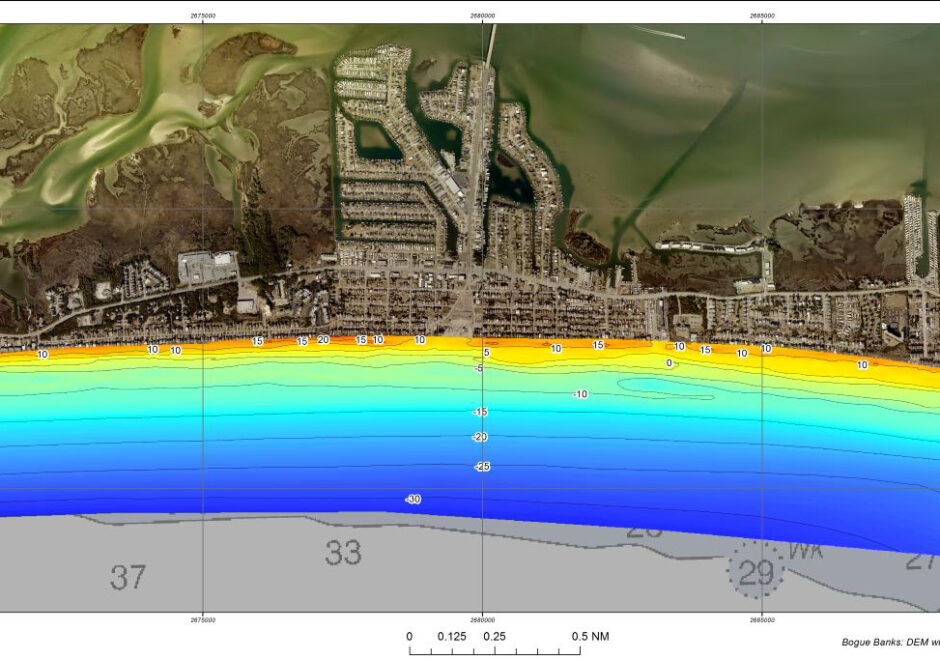
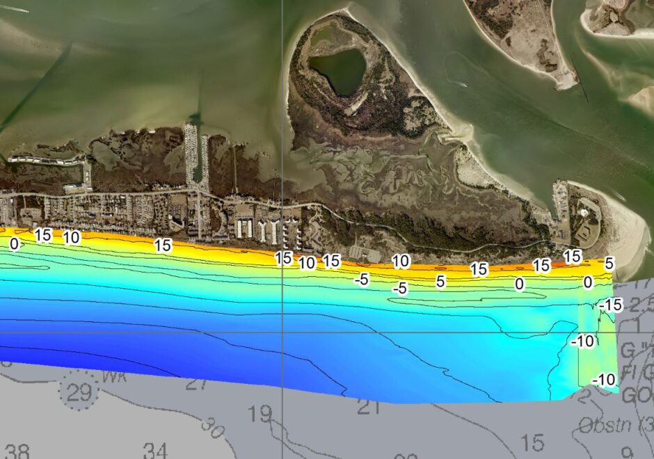
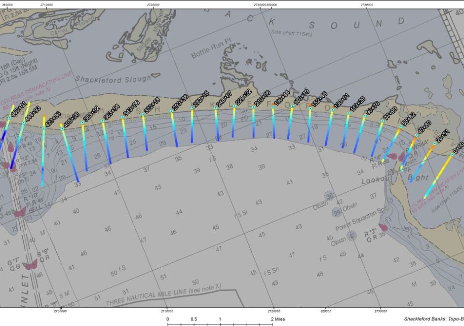
Hydrospatial has supported comprehensive annual shoreline surveys of Bogue Banks, Bear Island, and Shackleford Banks since 2008. Our accurate seamless hydrographic and topographic beach profiles support regional sediment management, beach nourishment, and coastal engineering needs of the Shore Protection Office.
In the most recently completed project year, our RTK-GPS hydrographic crews completed 166 topo-bathy profiles for the annual monitoring survey followed by an emergency post-storm beach profile assessment of 122 profiles on Bogue Banks in September after Hurricane Dorian. Surveys are conducted each spring to determine erosion / accretion in each management area and provide an annual “snapshot” of beach conditions before hurricane season. Our post-storm survey captures immediate sand loss from the system and supports volumetric change analysis and beach nourishment planning and engineering.
Geospatial Data Solutions
Review & Processing of Multibeam Sonar Data from the Florida Keys National Marine Sanctuary
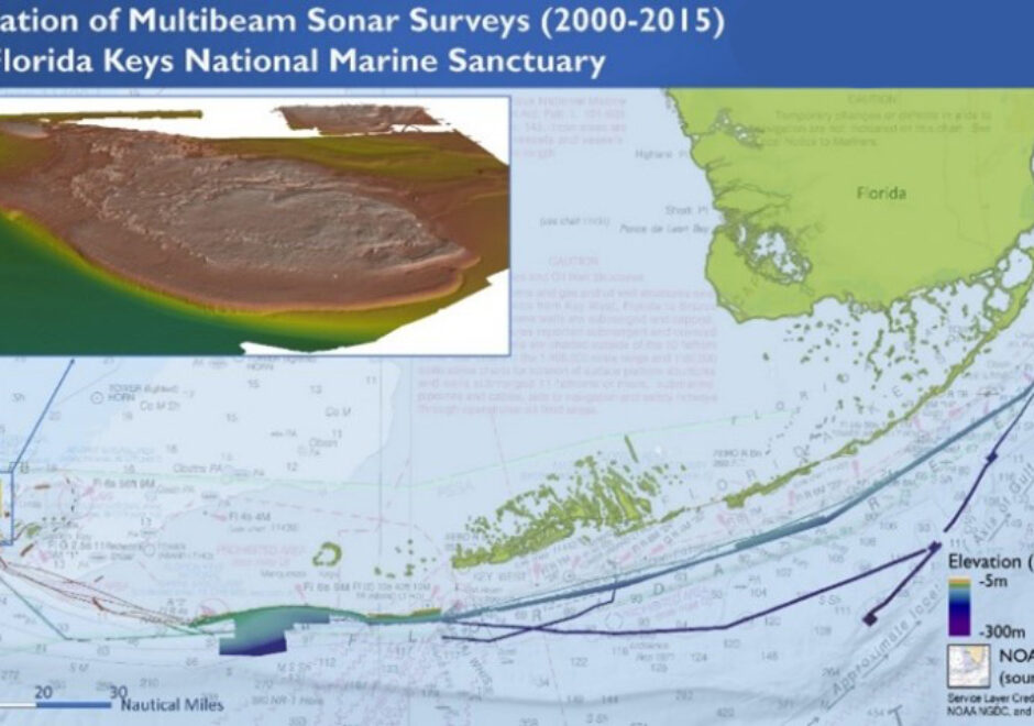
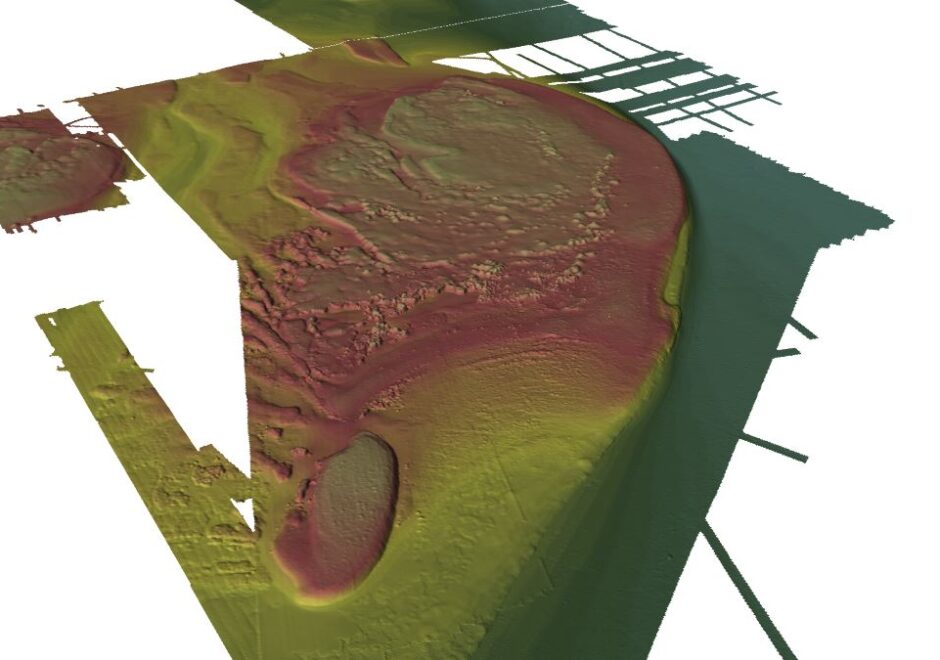
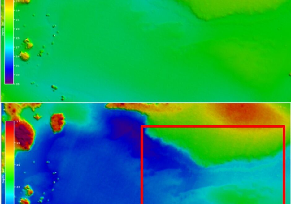
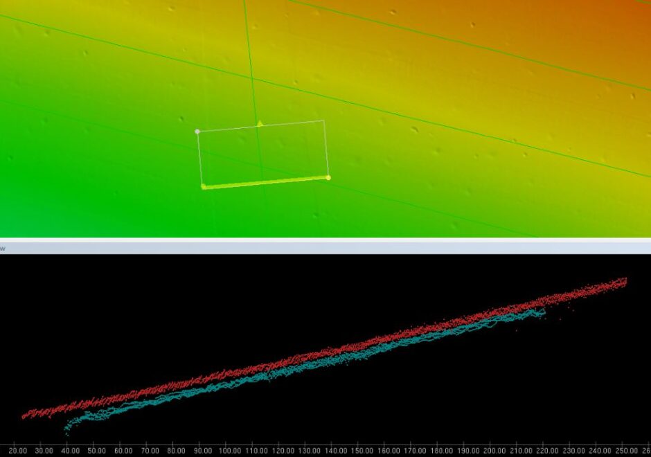
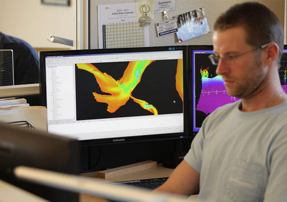
In 2015, the NOAA/NOS Center for Coastal Fisheries and Habitat Research contracted Hydrospatial for review, processing, data management and deliverable production of archived multibeam sonar data that had been collected aboard the NOAA Ships Nancy Foster and Thomas Jefferson from 2004 to 2015. The seabed elevation and acoustic imagery data (backscatter) were collected and preliminarily processed by NOAA to correct for motion, sound speed and major artifacts, but had been found to contain various persistent artifacts, biases, and a lack of quality tidal corrections.
Hydrospatial provided appropriate staff, computer, and software resources to complete a full review of the data provided and apply verified NOAA zoned definition tide files so that NOAA CCFHR fisheries scientists could use the seabed data to characterized bottom habitats in the Florida Keys National Marine Sanctuary and adjacent areas. The corrected bathymetry surfaces will be used to interpret the seafloor topography habitat types and extend the range of existing habitat map products that were created by manual interpretation of satellite imagery. Data deliverables included thoroughly cleaned and accurate bathymetric datasets contained within CARIS projects, along with metadata that will support future use of the data as a tool for scientific study.
Coastal Mapping Online Database
We have delivered marine eGIS solutions to serve as decision support tools for managing marine minerals, improving sea turtle safety, and mapping essential fish habitat, and we have updated environmental sensitivity index (ESI) maps for a number of states to ensure oil spill response preparedness. Visit our eGIS page to learn more.
Support Services
Jacksonville Operational Range Bottom Mapping & Benthic Habitat Characterization
We have delivered marine eGIS solutions to serve as decision support tools for managing marine minerals, improving sea turtle safety, and mapping essential fish habitat, and we have updated environmental sensitivity index (ESI) maps for a number of states to ensure oil spill response preparedness. Visit our eGIS page to learn more.
Survey and Assessment of Benthic Habitat for Offshore Wind Development
We have delivered marine eGIS solutions to serve as decision support tools for managing marine minerals, improving sea turtle safety, and mapping essential fish habitat, and we have updated environmental sensitivity index (ESI) maps for a number of states to ensure oil spill response preparedness. Visit our eGIS page to learn more.
Hydrographer Support for Essential Fish Habitat
We have delivered marine eGIS solutions to serve as decision support tools for managing marine minerals, improving sea turtle safety, and mapping essential fish habitat, and we have updated environmental sensitivity index (ESI) maps for a number of states to ensure oil spill response preparedness. Visit our eGIS page to learn more.
Client
USACE Wilmington District
Location
Wilmington, NC
Services
Hydrographic
Topographic
Surveys in Support of Saltmarsh Restoration
Client
NOAA
Location
Chicago
Services
Hydrographic
Partners
Text
Client
NC State Port Authority
Location
Morehead City, NC
Services
Hydrographic
Topographic
Geospatial Data Solutions
Resources
Client
USACE Wilmington District
Location
Kure Beach, NC
Services
Hydrographic
Geophysical
Client
L3 MariPro, Inc
Location
Jacksonville, FL
Services
Hydrographic
Geophysical
Geospatial Data Solutions
Hydrographic
Support Services
Client
USACE Wilmington District
Location
Pamlico Sound, NC
Services
Hydrographic
Geophysical
Geospatial Data Solutions
Client
USACE Norfolk District
Location
NASA Wallops Flight Facility, Wallops Island and Assateague Island, VA
Services
Hydrographic
Mobile Laser Scanning
Geospatial Data Solutions
Topographic
Partners
Client
USACE Wilmington District
Location
Wilmington, NC
Services
Hydrographic
Mobile Laser Scanning
Topographic
Client
Great Lakes Dredge and Dock Company
Location
Wilmington, NC
Services
Topographic
Support Services
Partners
Client
Carteret County, NC
Location
Carteret County, NC
Services
Hydrographic
Topographic
Partners
Client
NOAA Center for Coastal Fisheries and Habitat Research
Location
Newport, NC
Services
Geospatial Data Solutions
Support Services