Geospatial Software
We are NV5 Geospatial
Enterprise GIS
Digital Twin
Marine Hydrography
Environment
ENVI Ecosystem
ENVI Ecosystem offers a suite of solutions that are easily tailored to diverse organizational needs and users. Learn more
NV5 Geospatial’s remote sensing data analysis improves efficiency, reduces risk, and maximizes reliability of your distribution network. Learn more
airport solutions
Airport Solutions
Whether it’s master planning & ALPs, Obstruction Analysis, or Veg Mgmt, we stick the landing for airport management solutions. Learn more
Our expertise in both near-shore and off-shore survey is instrumental in the wind siting process, particularly near-shore analysis for cabling efforts. Learn more
NV5 Geospatial’s remote sensing data analysis improves efficiency, reduces risk, and maximizes reliability of your distribution network. Learn more
Digital Twin Guide
Download Guide
So what really comprises a digital twin? How can your organization implement a successful digital twin efficiently? Download our guide to Understanding and Implementing Digital Twins
Digital Twin Guide
Download Guide
So what really comprises a digital twin? How can your organization implement a successful digital twin efficiently? Download our guide to Understanding and Implementing Digital Twins
NV5 Geospatial and Geodynamics LLC, an NV5 company, experts Kurt Allen, Sloan Freeman, and Rudi Rudolph, hit The American Shoreline Podcast airwaves on Coastal News Today to share the latest technology and solutions for mapping the nearshore.
Does your data quality review process need a boost? Introducing INSITE Data Reviewer, our app with real-time access to geospatial data via the cloud to standardize quality control. Learn more by attending our webinar on April 20th
NV5 has held the Esri Platinum Partner status in the Esri Partner Network since 2010 and maintains seven Esri specialty designations, NV5’s staff are experienced and maintain key certifications across the Esri environment.
NV5 awarded 2023 Esri’s Cloud System Implementation Award
In recognition of NV5’s enablement of customer success through comprehensive implementation of the ArcGIS system in the cloud. Learn more
NV5 Receives 2023 Esri IMGIS Utility Network Implementation Award
NV5 is recognized at IMGIS for excellence in bringing ArcGIS Utility Network to bear for utilities across the United States. Learn more
NV5 has held the Esri Platinum Partner status in the Esri Partner Network since 2010 and maintains seven Esri specialty designations, NV5’s staff are experienced and maintain key certifications across the Esri environment.
NV5 awarded 2023 Esri’s Cloud System Implementation Award
In recognition of NV5’s enablement of customer success through comprehensive implementation of the ArcGIS system in the cloud. Learn more
3 Reasons to Implement Esri's ArcGIS Utility Network Management Solution
Watch NV5 experts discuss the capabilities and benefits of Utility Network. Watch Video

The Path to Smarter, Connected Asset Management
Organizations everywhere are working toward AI-driven operations, but legacy and on-prem systems often stand in the way. Trimble Unity changes that. It’s not just another

NV5 Becomes First to Deploy Hexagon’s Leica CoastalMapper, Ushering in a New Era of Coastal and Riverine Mapping
Frankfurt, Germany — NV5, a division of Acuren Corporation (the “Company” or “Acuren”, NYSE: TIC), a provider of tech-enabled engineering, certification, consulting, and geospatial solutions,

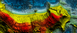
From Ship to Shore: How NV5’s Solutions are Modernizing Great Lakes Mapping
With over 5,300 miles of U.S. coastline, the Great Lakes are a cornerstone of North American commerce, ecology, and recreation. For nearly a decade, the