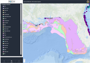
Mapping the Coasts of the US
Alexa Ramirez, eGIS Project Manager for NV5 Geospatial, describes how custom eGIS applications are improving accessibility to geospatial data in an effort to improve coastal
Alexa Ramirez, eGIS Project Manager for NV5 Geospatial, describes how custom eGIS applications are improving accessibility to geospatial data in an effort to improve coastal

Michael B. Shillenn,CP, ASPRS senior account manager for NV5 Geospatial has been elected to serve on the board of MAPPS, the preeminent national association of
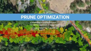
Prune Optimization – Wednesday, August 25th @ 2 PM ET. Access Recording NV5 Geospatial, powered by Quantum Spatial, North America’s largest geospatial data firm, today announced

The NV5 Geospatial Anchorage office focuses on conducting environmentally responsible and sustainable projects across Alaska that help us adapt to a changing landscape and climate
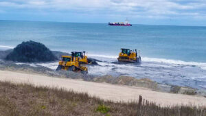
NV5’s Geodynamics, in conjunction with engineering firm Moffatt & Nichol, will develop a study to evaluate sand sources for nourishment projects on Bogue Banks. Read

HOLLYWOOD, Fla., July 07, 2021 (GLOBE NEWSWIRE) — NV5 Global, Inc. (the “Company” or “NV5”) (Nasdaq: NVEE), a provider of professional and technical engineering, geospatial,
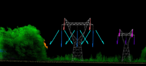
Electric utilities have been under intense scrutiny in recent years, plagued with questions about reliability because of expansive power outages and facing potential culpability for

Tracy Cozzens, senior editor of Geospatial Solutions, writes about the women of NV5 Geospatial’s eGIS team, and the diverse work they do to support science

Register Here NV5 Geospatial’s INSITE LIFECYCLE combines project tracking with data quality assurance and control. Providing instant access to geospatial data allows for a collaborative

Evon Silvia, solutions architect with NV5 Geospatial, is chair of the ASPRS LAS Working Group. Dedicated to the development and standardization of lidar data, Evon