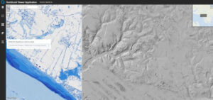
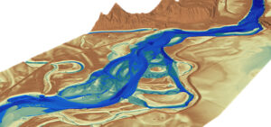
Web GIS Improves LiDAR Collection Response Time
In the latest issue of GIM International, Quantum Spatial’s Cherie Jarvis discusses the process of utilizing eGIS mapping applications in order to improve outcomes of
In the latest issue of GIM International, Quantum Spatial’s Cherie Jarvis discusses the process of utilizing eGIS mapping applications in order to improve outcomes of

Quantum Spatial, Inc. (QSI), the nation’s largest independent geospatial data firm, today announced that Quantum Spatial won Zpryme’s start@ETS pilot pitch competition for having the most
As seen on PRWeb, LiDAR Magazine, POB, and Directions Magazine: Quantum Spatial, Inc. (QSI), the nation’s largest independent geospatial data firm, announced that it is currently working on more than
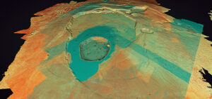
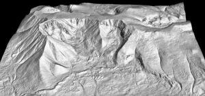
LiDAR data, collected by Quantum Spatial, is proving a useful tool in mapping the volcano and lava flows on the Big Island of Hawaii. Tracy Cozzens of

Hurricanes, flooding, landslides, wildfires and erupting volcanoes- rarely a week goes by without a headline about these types of natural disasters, which result in untimely
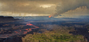
Quantum Spatial has conducted a LiDAR survey and data analysis of the volcanic activity in Hawaii. Tracy Cozzens, of Geospatial Solutions details how USGS Hawaiian
This week, five Quantum Spatial geospatial professionals — Russ Faux, senior vice president, Enterprise Growth Initiatives; Kurt Allen, Federal Programs Lead, Colin Cooper, technical domain

Quantum Spatial, Inc. (QSI), the nation’s largest independent geospatial data firm, today announced that Anand Iyer, the company’s senior vice president for Products & Technology,

Quantum Spatial’s Mike Fuller discusses the latest advancements in remote sensing platforms- drones and robots- and how their emergence has revealed new insights across a variety
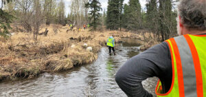
Quantum Spatial made headlines this past weekend helping to keep Anchorage’s waterways clean. Marking the third consecutive year, the team participated in Anchorage Waterways Council’s Creek Cleanup.