Assessing the potential: Topobathymetric LiDAR surveys
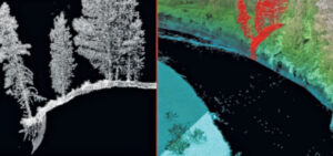
Colin Cooper and Russ Faux discuss the possibilities of topobathy LiDAR survey and evaluate the latest sensor technology and deployment methods in the most recent
Colin Cooper and Russ Faux discuss the possibilities of topobathy LiDAR survey and evaluate the latest sensor technology and deployment methods in the most recent
Cherie Jarvis, Quantum Spatial’s Enterprise GIS Practice Lead, recently shared her insights into the benefits and best practices of agile software development in a SD
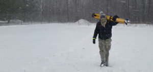
In celebration of National Surveyors Week, we’re spotlighting some of our dedicated surveyors and sharing their insights of a survey career. If you are interested
In celebration of National Surveyors Week, we’re spotlighting some of our dedicated surveyors and sharing their insights of a survey career. If you are interested
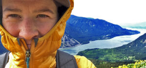
In celebration of National Surveyors Week, we’re spotlighting some of our dedicated surveyors and sharing their insights of a survey career. If you are interested
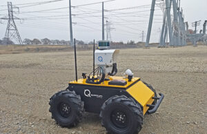
Autonomous Robotic Platform Featuring LiDAR, Thermal and Multispectral Sensors Enables Remote Change Detection in Substation Environments St. Petersburg, Fla. – March 2, 2018 – Quantum

Quantum Spatial, Inc.(QSI), the nation’s largest independent geospatial data firm, today announced that three of its LiDAR experts will be featured speakers at International LiDAR
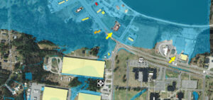
Michael Shillenn, of Quantum Spatial, details how North Carolina is managing flood risk through improved mapping and analysis of LiDAR data, made possible via the

Jim DePasquale, of the The Nature Conservancy, shares his knowledge and experience of the USGS’ 3D Elevation Program (3DEP) and how the data is employed to

The New Year is right around the corner, which means the Quantum Spatial 2018 calendar is here! We have a downloadable desktop calendar that captures an