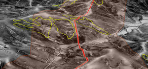
Leveraging 3DEP Partnerships to Map Uncharted Lands
Jim DePasquale, of the The Nature Conservancy, shares his knowledge and experience of the USGS’ 3D Elevation Program (3DEP) and how the data is employed to
Jim DePasquale, of the The Nature Conservancy, shares his knowledge and experience of the USGS’ 3D Elevation Program (3DEP) and how the data is employed to
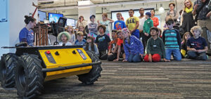
For the third consecutive year, Quantum Spatial has hosted Ms. Caroline Coholan’s 3rd grade class, from Llewellyn Elementary School at the Portland office to celebrate
Cherie Jarvis, eGIS Practice Lead at Quantum Spatial It’s hard to remember a time when we didn’t have abundant free mapping applications. These days we
Tammy Baldwin speaks about the positive impact of the Digital Coast program via video conference at the 2nd annual Acquisition Summit hosted by Quantum Spatial. The
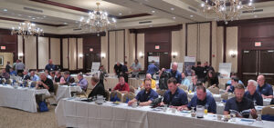
Quantum Spatial’s second annual acquisition is underway this week. The event brings together remote sensing and geospatial industry leaders to share new innovations, showcase emmerging
Quantum Spatial continues to develop invaluable solutions to improve safety and reliability within the pipeline industry. The August edition of Pipeline & Gas Journal highlights
Developed by USGS and federal partners to respond to the growing national need for high-quality topographic data and other 3D representations of natural and constructed
ST. PETERSBURG, FLORIDA (PRWEB) JUNE 20, 2017 Quantum Spatial, Inc., the nation’s largest independent geospatial data firm, today announced that it has acquired the complete collection
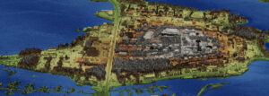
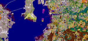
For GIS professionals, overlaying multiple geospatial data layers on a map for analysis and decision making is all part of a day’s work, but for
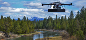
Teaming with experts from LiDAR manufacturer RIEGL, Quantum Spatial, Inc. was recently involved in an exciting new test of RIEGL’s newest sUAS technology innovation for hydrographic applications –