Happy Holidays from Quantum Spatial!
We’d like to share one of our favorite holiday traditions – a stunning aerial photo with the yearly calendar for your computer desktop wallpaper.
We’d like to share one of our favorite holiday traditions – a stunning aerial photo with the yearly calendar for your computer desktop wallpaper.
Quantum Spatial collected and analyzed LiDAR data for Utah’s Automated Geographic Reference Center. Government officials and researchers are using the LiDAR datasets in applications ranging

Quantum Spatial is hiring a service specialist to provide first-rate IT support in a friendly, helpful way that builds trust and education, ensuring our teams
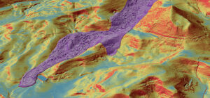
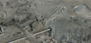
The cover story of the October issue of LiDAR News features Quantum Spatial’s breakthrough solutions regarding landslide mitigation efforts, and how the results generate a
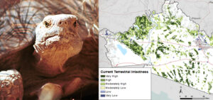
What is the REA program? Managed by the BLM, the Rapid Ecoregional Assessment (REA) program integrates varied datasets in order to evaluate ecosystem dynamics, habitat

A Photographer and Engineer, Clyde Sunderland was a distinguished aerial photographer known for his work of both vertical and oblique images of the greater San
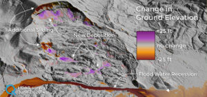
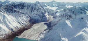
The devastating landslide of Oso, Washington, which claimed the lives of 43 people on March 22, 2014, continues to alter the landscape. Quantum Spatial conducted
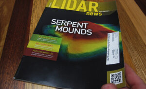
As seen on the Discovery Channel and featured in LiDAR News, Quantum Spatial assisted an archeological and anthropological investigation of ancient mounds by employing our aerial, terrestrial, and
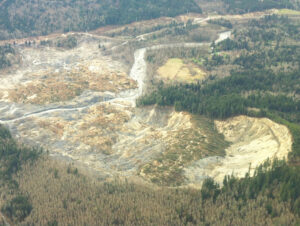
Landslides are a major geologic hazard. As urban and recreational development expands into hillside areas, more and more people and critical infrastructure—including power lines, roads