The Role of Remote Sensing in Monitoring Climate Change Impacts
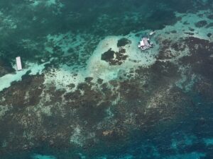
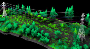
In a previous post, we introduced the Caribbean Community Climate Change Centre’s (CCCCC) initiative with NV5 to combat climate change through aerial lidar and orthoimagery
In a previous post, we introduced the Caribbean Community Climate Change Centre’s (CCCCC) initiative with NV5 to combat climate change through aerial lidar and orthoimagery
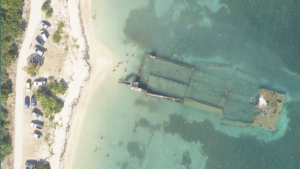
The Caribbean is a region known for its vibrant culture and breathtaking landscapes. However, it is also particularly vulnerable to the impacts of climate change.
Kentucky Project Spanning 40,660 Square Miles Democratizes Access to Detailed Information to Improve Public Safety and Bolster Revenue Generation Across the CommonwealthHOLLYWOOD, Fla., April 11,
HOLLYWOOD, Fla., April 04, 2024 (GLOBE NEWSWIRE) — NV5 Global, Inc. (the “Company” or “NV5”) (Nasdaq: NVEE), a provider of technology, conformity assessment, and consulting solutions announced
We’re recapping the 2024 Esri Developer Summit with insights from the event earlier this month on product updates, new technology, emerging trends, and other big

Located in the Seattle metropolitan area on an island in the southern portion of Lake Washington, Mercer Island has a population of over 25,000 residents.
NV5 Geospatial’s Thermal Infrared Solutions Gain Traction for U.S. Infrastructure Challenges Pilot projects with two midwestern state’s Departments of Transportation analyze the structural integrity of
HOLLYWOOD, Fla., Dec. 12, 2023 (GLOBE NEWSWIRE) — NV5 Global, Inc. (the “Company” or “NV5”) (Nasdaq: NVEE), a provider of technology, conformity assessment, and consulting
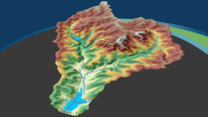
NV5 Geospatial Honored with Missouri Conservation Innovation Partner Award NV5 Geospatial and Aerial Services Inc. Highlighted for Ground-Breaking 3D Elevation Derived Hydrography Project to Map
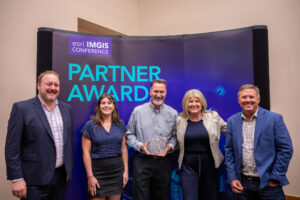
NV5 has been honored with the Utility Network Implementation award at the 2023 Esri Infrastructure Management and GIS (IMGIS) Conference in Palm Springs, California. The