In celebration of International Podcast Day, we’re sharing podcasts where NV5 Geospatial’s expertise shed light on various topics within the industry. From discussions like how lidar provides value to organizations, how the sensors now available are changing data collection, key trends in disaster response, and more. Check them out below![...]
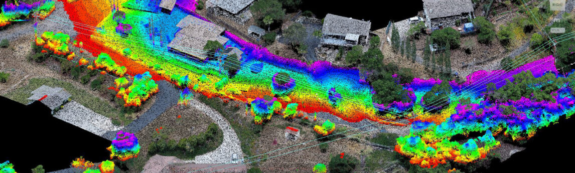
Find your way with NV5 Geospatial’s data analysis for oversize freight transport. View Flyer NV5 Geospatial uses lidar to perform three-dimensional swept path clearance analysis for roads, bridges, tunnels, and other transportation infrastructure elements.Analysis is performed to determine if the oversize freight will be able to navigate a proposed route[...]
Sven Cowan, Canada Program Manager for NV5 Geospatial, discusses the capabilities of INSITE Project Tracker a cloud-based data application for Go Geomatics Canada. The INSITE Lifecycle Project Tracker Tool from NV5 Geospatial is a scalable, agnostic platform for project tracking and quality assurance. The cloud-based platform simplifies and automates the[...]
Listen The UAV Podcast discusses how drones and other autonomous vehicles are deployed with lidar sensors to create 3D mapping data and downstream analytics with NV5 Geospatial’s Lukas Fraser. From UAV Podcast: “Lukas Fraser is a lidar Specialist working in the Geospatial Group at NV5. He creates engineering-grade[...]
Form #2 - Sends email containing the link to the PDF
"*" indicates required fields
eNewsletter - NV5 Real Estate Transaction Services
Contact NV5 Real Estate Transaction Services
Download NV5 2022 Compliance Calendar
Please fill out the form below. After successful form submission, you will be redirected to the requested file. Thank you.
"*" indicates required fields
Hyperspectral Imaging - Technically Speaking
Our internal innovation and development team constantly analyzes new technology and develops solutions to meet our client’s challenges. Our Technically Speaking series is one way we share our technical findings with the professional community.
Please tell us a little about yourself by filling out the form below, and we’ll share the document with you, thanks!
Accuracy Part 1- Technically Speaking
Our internal innovation and development team constantly analyzes new technology and develops solutions to meet our client’s challenges. Our Technically Speaking series is one way we share our technical findings with the professional community.
Please tell us a little about yourself by filling out the form below, and we’ll share the document with you, thanks!
Prune Optimization Webinar Recording
NV5 Geospatial releases a new predictive modeling platform for vegetation management that uses existing lidar and historical data to identify the relative level of asset risk from trees by quantifying the potential for causing asset damage.
Please tell us a little about yourself by filling out the form below, and we’ll share the document with you, thanks!
Topobathy Lidar - Technically Speaking
Our internal innovation and development team constantly analyzes new technology and develops solutions to meet our client’s challenges. Our Technically Speaking series is one way we share our technical findings with the professional community.
Please tell us a little about yourself by filling out the form below, and we’ll share the document with you, thanks!