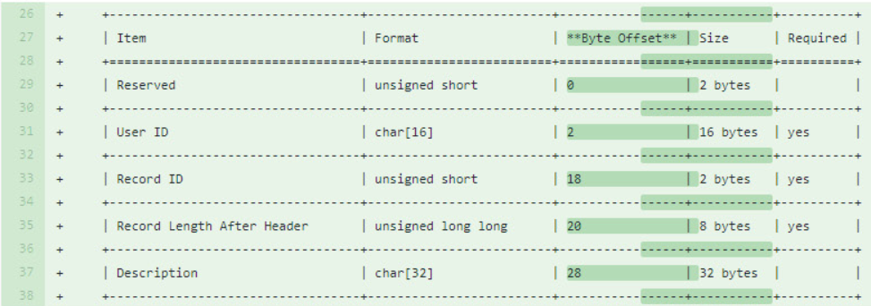
LAS Exchange: LAS Working Group Releases First Public Registry
Evon Silvia, solutions architect with NV5 Geospatial, is chair of the ASPRS LAS Working Group. Dedicated to the development and standardization of lidar data, Evon
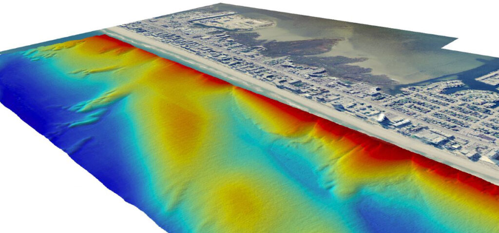
NV5 Geospatial Expands Breadth of Deep-Water and Near-Shore Survey Offerings with Acquisition of Geodynamics
With the recent acquisition of Geodynamics LLC, NV5 Geospatial has built one of the most comprehensive suites of solutions for geospatial surveys of deep water and
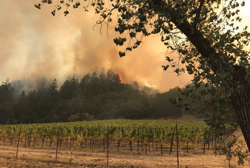
Combating California Crises with Maps
Wild fires once again threaten the west coast this season as they have each summer in recent memory. Kass Green, reporting in Lidar Magazine, details

NV5 Geospatial Speaks for the Trees
https://www.youtube.com/watch?v=-uK4fObNyWs&authuser=0 In honor of Arbor Day, we’re sharing Dr. Andrew Brenner’s presentation on remote sensing data applications and analysis for forestry and tree sciences. For
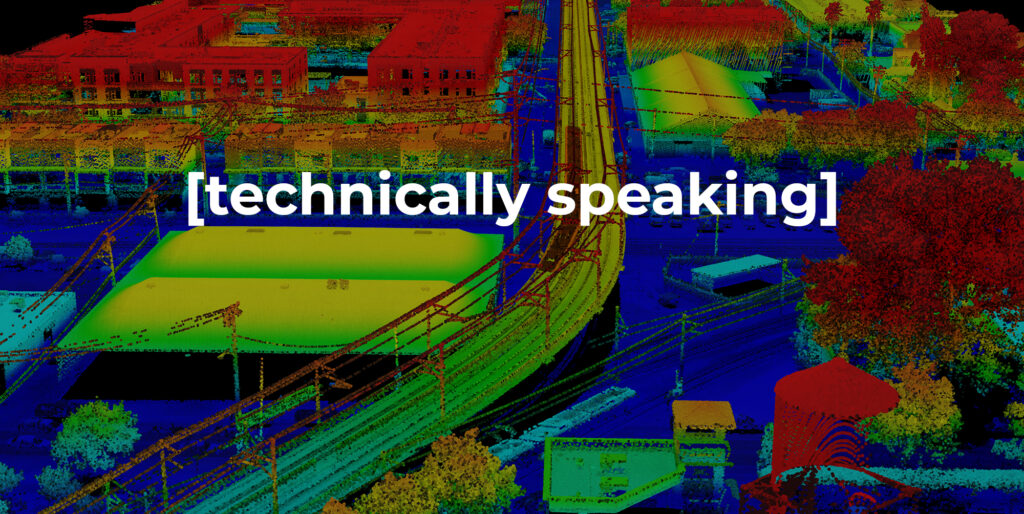
Technically Speaking – Accuracy Part II
Dive into our latest Technically Speaking article to understand the intricacies of geospatial accuracy and considerations to achieve reliable, quality lidar data. This is the
Oversize Freight Clearance Analysis
Find your way with NV5 Geospatial’s data analysis for oversize freight transport. View Flyer NV5 Geospatial uses lidar to perform three-dimensional swept path clearance analysis for
INSITE Lifecycle Project Tracker Enables & Delivers Real-Time Data Updates
Sven Cowan, Canada Program Manager for NV5 Geospatial, discusses the capabilities of INSITE Project Tracker a cloud-based data application for Go Geomatics Canada. The INSITE