UAV Podcast: Lidar Mapping with UAVs (Drones)
Listen The UAV Podcast discusses how drones and other autonomous vehicles are deployed with lidar sensors to create 3D mapping data and downstream

NV5 Acquires Geodynamics, Expanding Deep-Water Geospatial Capabilities
HOLLYWOOD, Fla., March 29, 2021 (GLOBE NEWSWIRE) — NV5 Global, Inc. (the “Company” or “NV5”) (Nasdaq: NVEE), a provider of compliance, technology, and engineering consulting

Alaska Virtual Geospatial Gathering March 1st – 4th
Registration is open for the Alaska Virtual Geospatial Gathering March 1st – 4th. We have over two dozen speakers lined up to cover geospatial topics
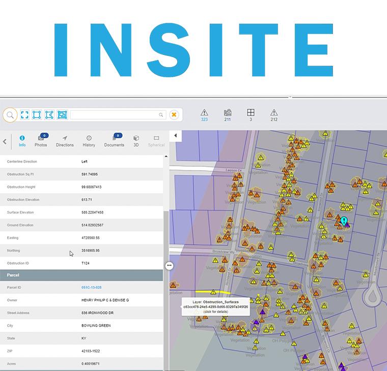
NV5 Geospatial Unveils INSITE, a Cloud-based Geospatial Data Management Platform
NV5 Global, Inc. (the “Company” or “NV5”) (Nasdaq: NVEE), a provider of compliance, technology, and engineering consulting solutions, announced today that NV5 Geospatial, formerly Quantum Spatial,
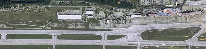
Geospatial Data for Airports
Bob Vander Meer, vice president of business development for NV5 Geospatial (Powered by Quantum Spatial), discusses NV5 Geospatial’s work with Airports on the Airplane Geeks Podcast. Bob has over
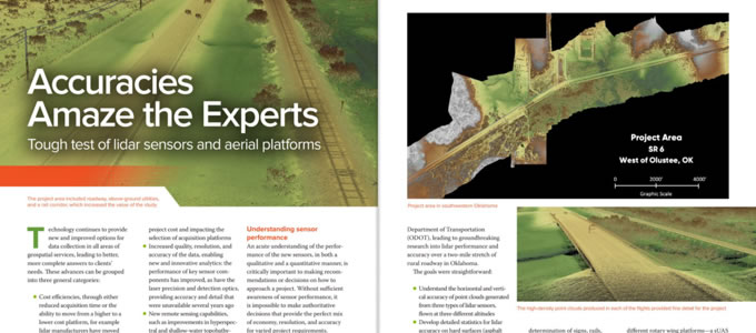
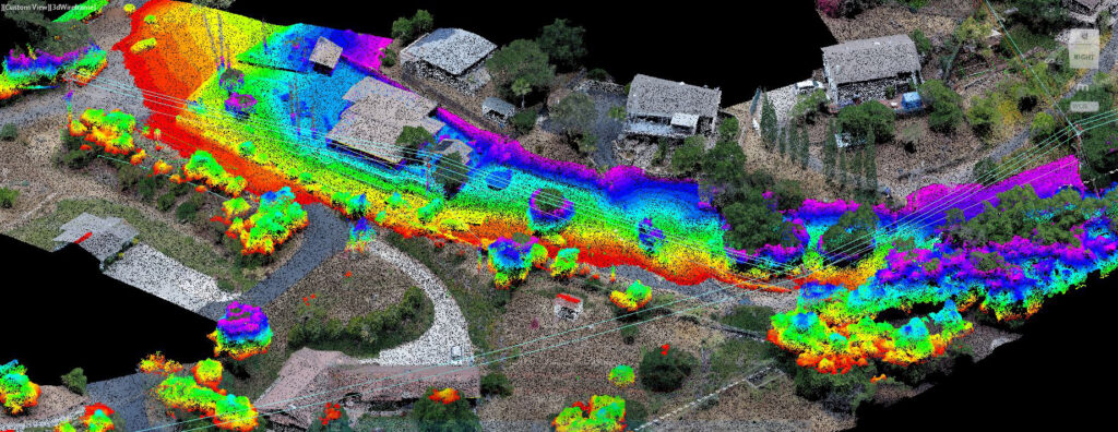
Accuracies Amaze the Experts
Lidar technology continues to advance, both in terms of sensor hardware and platform deployment. NV5 Geospatial and Oklahoma Department of Transportation performed a series of tests

Changing Responses to Changing Disasters
Zpryme On The Grid · Changing Responses to Changing Disasters w/ Ian Berdie Zpryme’s Dylan Lockwood speaks with Ian Berdie, Vice President of Innovation
NV5 Geospatial Gains Momentum in Canada with Series of Topobathymetric Lidar and Aerial Imagery Wins in 2020
NV5 Geospatial, powered by Quantum Spatial, North America’s largest geospatial data firm, has dramatically expanded its Canadian operations in 2020, having been selected to provide lidar,