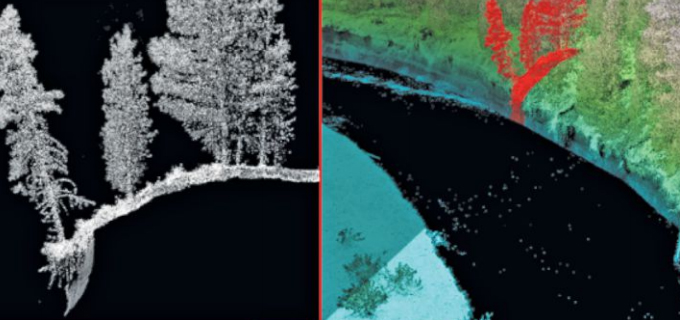
Assessing the potential: Topobathymetric LiDAR surveys
Colin Cooper and Russ Faux discuss the possibilities of topobathy LiDAR survey and evaluate the latest sensor technology and deployment methods in the most recent
Maximizing taxpayer ROI through agile development
Cherie Jarvis, Quantum Spatial’s Enterprise GIS Practice Lead, recently shared her insights into the benefits and best practices of agile software development in a SD
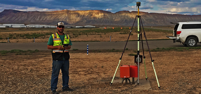
Acquisition team member Zeke shares his field experiences
In celebration of National Surveyors Week, we’re spotlighting some of our dedicated surveyors and sharing their insights of a survey career. If you are interested
Learn about surveyor life from Marc, one of Quantum Spatial’s dedicated professionals
In celebration of National Surveyors Week, we’re spotlighting some of our dedicated surveyors and sharing their insights of a survey career. If you are interested

Meet Casey, one of our extraordinary field surveyors
In celebration of National Surveyors Week, we’re spotlighting some of our dedicated surveyors and sharing their insights of a survey career. If you are interested
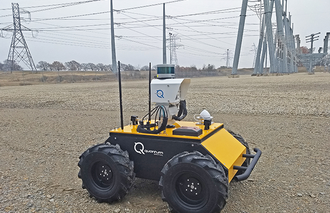
Quantum Spatial to Demonstrate Virtual Substation Monitoring at CEATI Spring Conference
Autonomous Robotic Platform Featuring LiDAR, Thermal and Multispectral Sensors Enables Remote Change Detection in Substation Environments St. Petersburg, Fla. – March 2, 2018 – Quantum
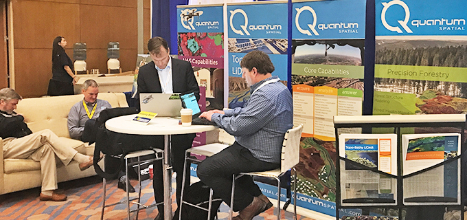
Quantum Spatial to Showcase Topobathy and Hydrography Innovations at International LiDAR Mapping Forum
Quantum Spatial, Inc.(QSI), the nation’s largest independent geospatial data firm, today announced that three of its LiDAR experts will be featured speakers at International LiDAR
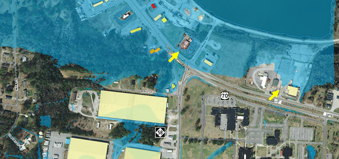
When Predictions Match Reality: The Power of LiDAR for Flood Warnings
Michael Shillenn, of Quantum Spatial, details how North Carolina is managing flood risk through improved mapping and analysis of LiDAR data, made possible via the

How to build a successful 3D Elevation Program partnership in your state
Jim DePasquale, of the The Nature Conservancy, shares his knowledge and experience of the USGS’ 3D Elevation Program (3DEP) and how the data is employed to