
Bring History to Life with Quantum Spatial’s Vast Image Archive
Are you interested in images from the golden age of flight, featuring groundbreaking aircraft and aviators like Amelia Earhart, Howard Hughes and Charles Lindbergh? Maybe
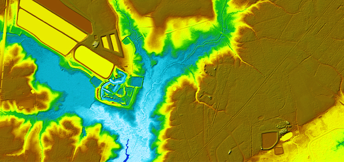
Revitalizing America’s Infrastructure via 3DEP
The American landscape changes constantly. Rapid land development and environmental forces make outdated elevation data irrelevant for current analysis. Advances in technology have exposed inaccuracies
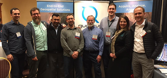
Hello Alaska! We’re at the Alaska Survey and Mapping Conference
Quantum Spatial is at the Alaska Survey and Mapping Conference in Anchorage. We are excited to share some of our recent work in remote sensing

Quantum Spatial to Present at International LiDAR Mapping Forum
Quantum Spatial, Inc. the nation’s largest independent geospatial data firm, will showcase its leadership in use of next-generation sensors to support wide-area programs, such as
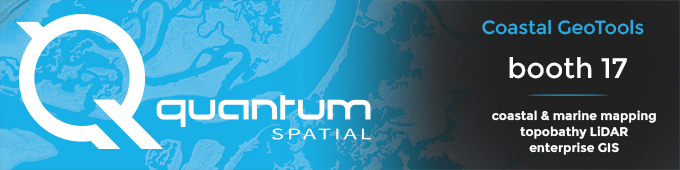
We’re at Coastal GeoTools 2017!
Quantum Spatial, Inc. the nation’s largest independent geospatial data firm, will showcase its industry-leading use of topographic-bathymetric (topo-bathy) LiDAR and advanced analytics to support natural
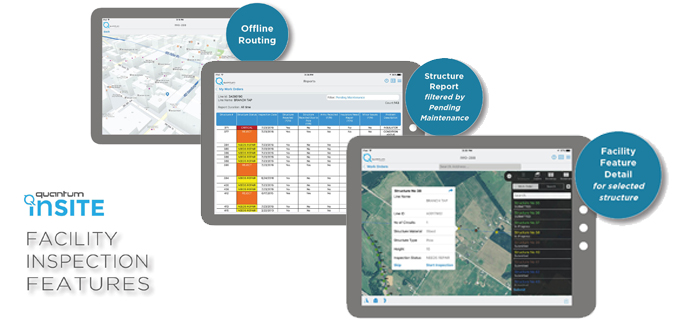
Quantum Spatial at DistribuTECH: Empowering the Geospatial Smart Grid
What if you could answer questions and tackle changes in your distribution system before they become problems? Distribution Network Intelligence builds foundationally on geospatial analytics

Helping our community! Brian organizes second annual food drive
For the second year in a row, the Portland, Oregon office of Quantum Spatial held a food drive to support the Oregon Food Bank. The
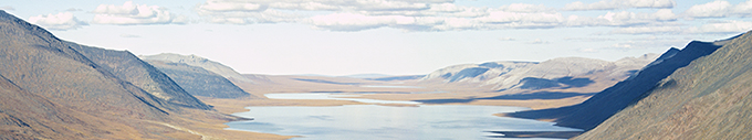
Our 2017 Calendar is available for download!
The new year is right around the corner, and we have a downloadable desktop calendar that showcases an amazing view of Chandler Lake, Alaska. There are
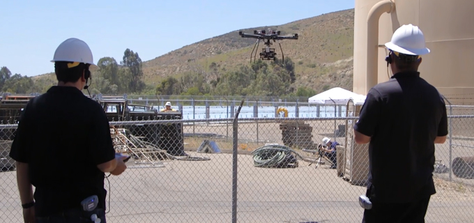
When are drones NOT the right answer?
Quantum Spatial’s Scott Nowicki was recently published in Directions Magazine discussing the current and future state of drones. The article explores optimal uses for drone